Welcome to BigEyeInTheSky.com
I'm Ed Fink, these are my 360 degree panoramas. I was the first photographer in the world to shoot 360 degree panoramas from a helicopter. Today I'm a FAA licensed drone pilot and shoot most of my aerials with a quadcopter.
In addition to shooting aerial panoramas, I'm also a Google Street View Trusted Photographer in Minneapolis shooting Street View tours inside local businesses.
I publish thousands of 360 degree panoramas and virtual tours to Google Maps, where I currently have over 100 MILLION VIEWS.
Ask me for more information or an estimate for your business!
Facebook - BigEyeInTheSky360
Google Maps - Ed Fink

VISITOR COMMENTS:
"That's the coolest thing on the web."
"You brought tears to my eyes."
"Mind blowing."
"One of the neatest photo sites I've ever seen."
"I'm afraid of heights and when I looked straight down I nearly threw up!"
"I am stunned by the quality and possible applications, nice job."
"That combo of eye-in-the-sky with eyes on the ground is fantastic."
"I sent this to every pilot I know."
"HOW IS THIS EVEN POSSIBLE?!"
"The 360 shots are almost unbelieveable!!!!"
"Oh my gosh Ed - they are just beautiful."
"That aerial panorama over Lake Calhoun is totally awesome"
"FANTASTIC!!!!"
"I've instantly become a fan of your panorama photos!"
"Wow, your panoramas are like nothing I have ever seen before. Very impressive!"
"the absolute best I have seen anywhere."
"ED - I am not surprised by all the comments you have received. The VR is AWESOME!"


Select a panorama category:
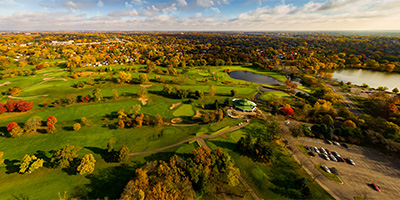
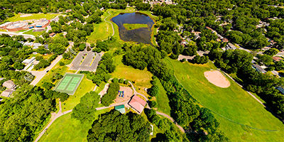
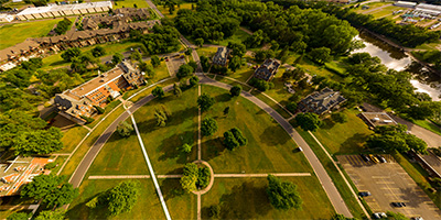
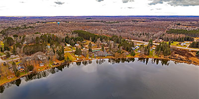
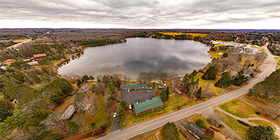
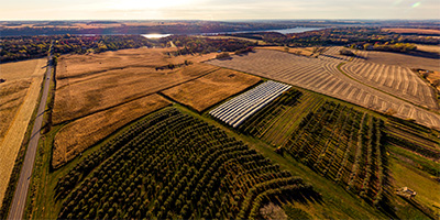
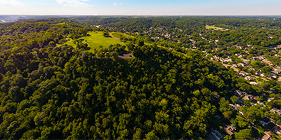
 360 degree aerial panorama at 77 North Inc., Germfask, MI.
Equipment: DJI Air2s, 22 mm
Categories: Quadcopter, Michigan U.P.
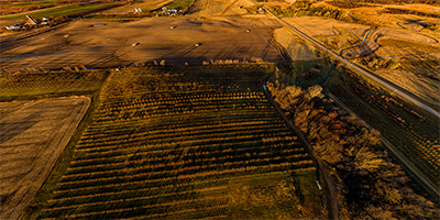
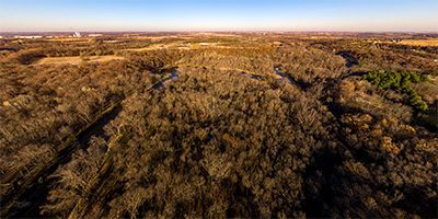
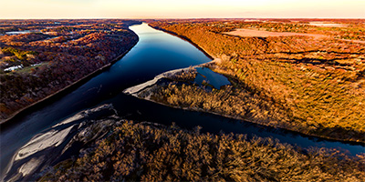
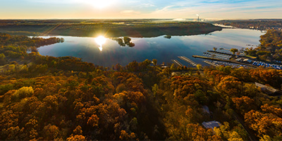
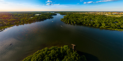
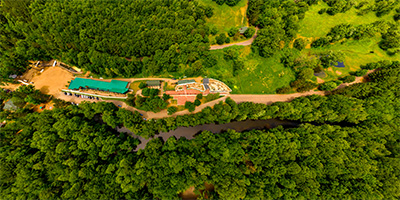
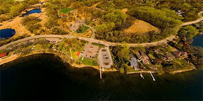
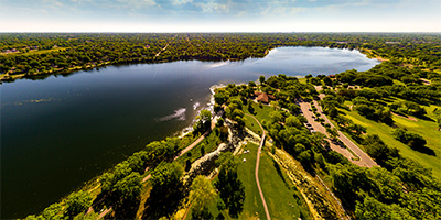
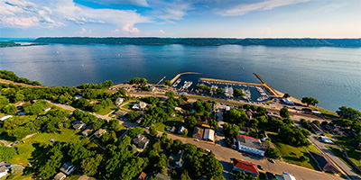
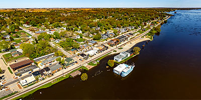
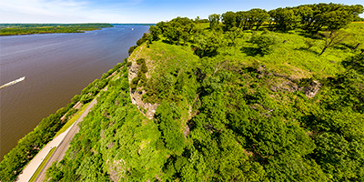
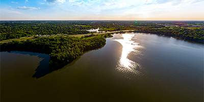
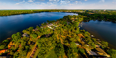
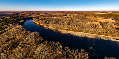
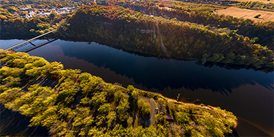
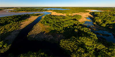
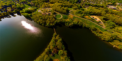
 360 degree aerial panorama over Maiden Rock Village Park along the Mississippi River in Maiden Rock, WI.
Equipment: DJI P4P, 24 mm
Categories: Mississippi River, Quadcopter, Wisconsin
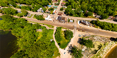
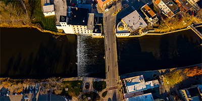
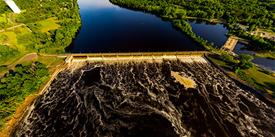
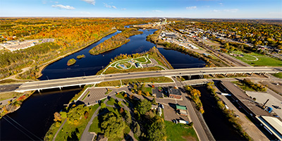
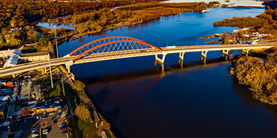
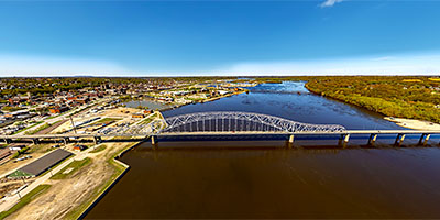
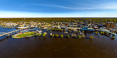
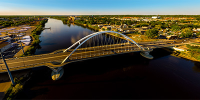
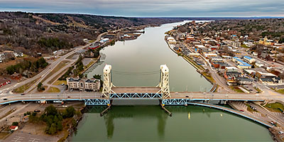
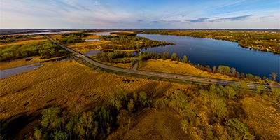
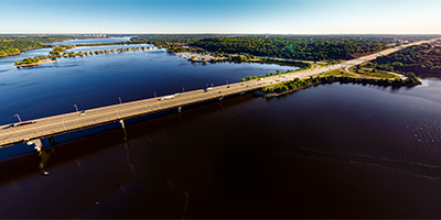 360 degree aerial panorama over the St. Croix River at the I-94 bridge in Hudson, WI.
Equipment: DJI P4P, 24 mm
Categories: Quadcopter, St Croix River, Wisconsin
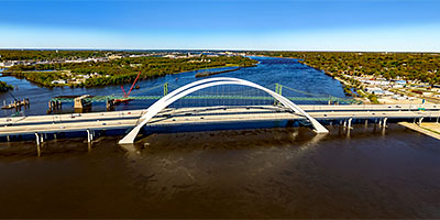
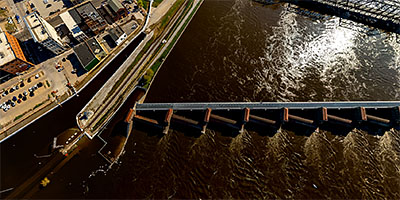
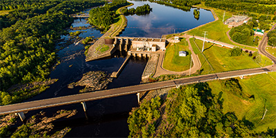
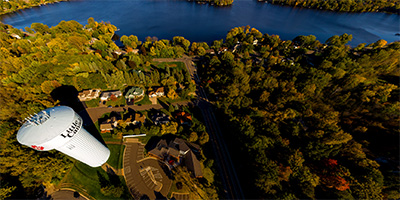
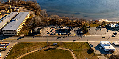
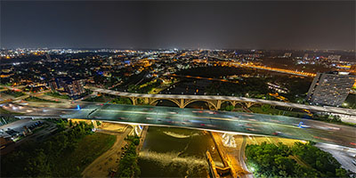 360 degree aerial panorama over Lock and Dam #1 near the I-35W Mississippi River Bridge in Minneapolis, MN, a few days after the 16th anniversary of the bridge collapse.
Equipment: DJI Air2s, 22 mm
Categories: 35W Bridge Collapse, Bridges, Featured, Minneapolis, Mississippi River, Quadcopter
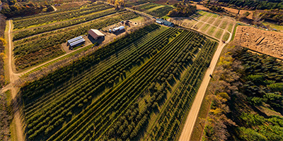
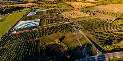
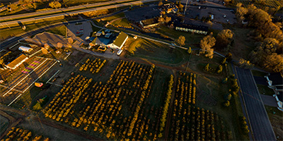
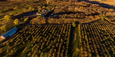
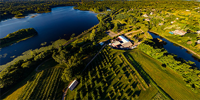
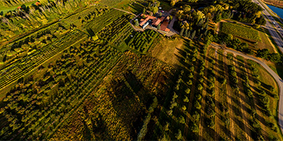 360 degree aerial panorama at Aamodt's Apple Farm west of Stillwater, MN.
Equipment: DJI P4P, 24 mm
Categories: Apple Orchards, Quadcopter, Stillwater
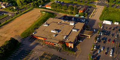
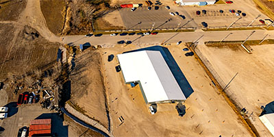
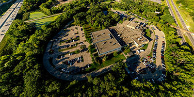 360 degree aerial panorama above Abbott near I-35E and Hwy. 36 in Little Canada, MN.
Equipment: DJI Air2s, 22 mm
Categories: Industrial, Quadcopter, Roseville
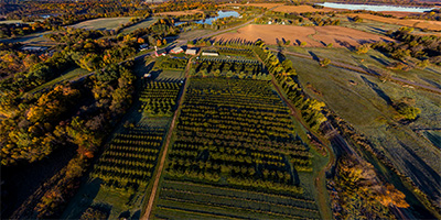
 360 degree aerial panorama during sunrise at Ablemans Apple Creek Orchard, west of Faribault, MN.
Equipment: DJI P4P, 24 mm
Categories: Apple Orchards, Outstate Minnesota, Quadcopter
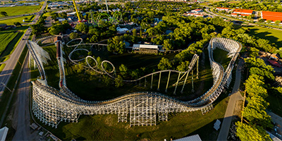 Sunset Over Adventureland Park in Des Moines, IA.
Equipment: DJI P3A, 20 mm
Categories: Iowa, Quadcopter
 360 degree aerial panorama during sunrise over Afton Apple Orchard near the St. Croix River.
Equipment: DJI P4P, 24 mm
Categories: Apple Orchards, Quadcopter, St Croix River
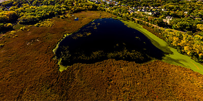
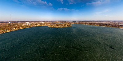
 360 degree aerial panorama above Goose Lake in Albert Lea, MN after a train derailment.
Equipment: DJI P4P, 24 mm
Categories: Industrial, Outstate Minnesota, Quadcopter, Railroads
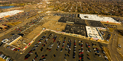
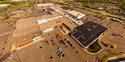
 Aerial panorama of Albertville Premium Outlets.
Equipment: DJI P3A, 20 mm
Categories: Quadcopter, Saint Cloud
 360 degree aerial panorama over Alexander Park along the Canon River Reservoir in Faribault, MN.
Equipment: DJI P4P, 24 mm
Categories: Outstate Minnesota, Quadcopter
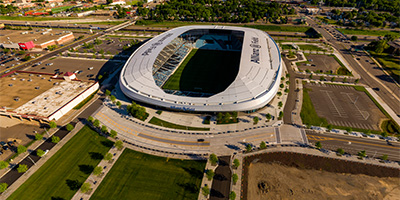 360 degree aerial panorama of the new Allianz Field soccer stadium in St. Paul, MN, home of the Minnesota United Foottball Club.
Equipment: DJI P4P, 24 mm
Categories: Featured, Quadcopter, Saint Paul
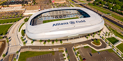 360 degree aerial panorama from the west of Allianz Field in St. Paul, MN, home of the Minnesota United Football Club.
Equipment: DJI P4P, 24 mm
Categories: Quadcopter, Saint Paul
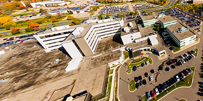
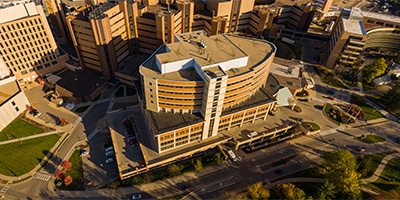 360 degree aerial panorama across from the American Family Children's Hospital at the University of Wisconsin in Madison, WI.
Equipment: DJI P4P, 24 mm
Categories: Madison, Wisconsin, Quadcopter, University of Wisconsin, Wisconsin
 360 degree aerial panorama in front of Ames Center in Burnsville, MN.
Equipment: DJI P3A, 20 mm
Categories: Quadcopter
 360 degree aerial panorama over the Mississippi River near Anoka-Ramsey Community College Coon Rapids Campus.
Equipment: DJI P4P, 24 mm
Categories: Mississippi River, Quadcopter
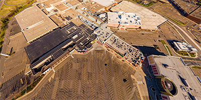
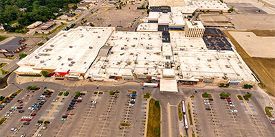
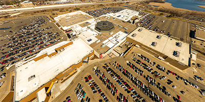
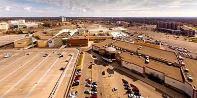
 360 degree aerial panorama of Apache Mall in Rochester, MN.
Equipment: DJI P4P, 24 mm
Categories: Quadcopter, Rochester
 360 degree aerial panorama of Apple Jack Orchards along the Crow River in Delano, MN.
Equipment: DJI P4P, 24 mm
Categories: Apple Orchards, Quadcopter
 360 degree aerial panorama over the Apple River downstream of Somerset, Wisconsin.
Equipment: DJI P4P, 24 mm
Categories: Apple River, Quadcopter
 360 degree aerial panorama over Apple River Falls and Spillway near Somerset, Wisconsin.
Equipment: DJI P4P, 24 mm
Categories: Apple River, Quadcopter
 Sunrise at the Arcola High Bridge over the Saint Croix River.
Equipment: DJI P4P, 24 mm
Categories: Bridges, Featured, Quadcopter, St Croix River
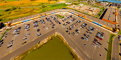
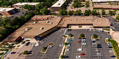 360 degree aerial panorama above Arden Plaza Shopping Center in Arden Hills, MN.
Equipment: DJI P4P, 20 mm
Categories: Quadcopter, Shoreview
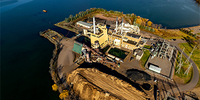 360 degree aerial panorama at Xcel Bay Front BIOMASS Power Plant on the shore of Chequamegon Bay in Ashland, WI.
Equipment: DJI Air2s, 22 mm
Categories: Duluth, Industrial, Quadcopter, Wisconsin

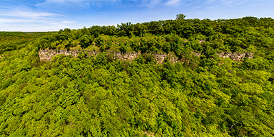
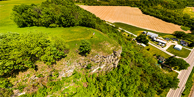
 360 degree aerial panorama at the Balltown Iowa Scenic Overlook, with Mississippi River in the distance to the north.
Equipment: DJI Air2s, 22 mm
Categories: Iowa, Mississippi River, Quadcopter
 Aerial panorama of Bandana Square Shopping Center.
Equipment: DJI P3A, 20 mm
Categories: Quadcopter, Saint Paul
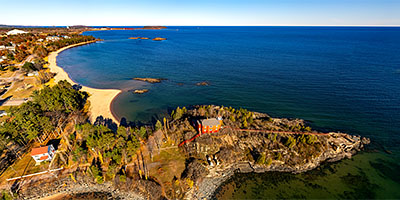
 360 degree aerial panorama over Keweenaw Bay, Lake Superior, near Baraga Cliff Roadside Park Michigan.
Equipment: DJI Air2s, 22 mm
Categories: Quadcopter, Michigan U.P.
 360 degree aerial panorama overlooking Lake Superior from above Bardon Peak Overlook on Spirit Mountain, along Skyline Parkway in Duluth, MN.
Equipment: DJI P4P, 24 mm
Categories: Duluth, Quadcopter
 Bell Museum, Minnesota's official natural history museum and planetarium in Falcon Heights, MN.
Equipment: DJI P4P, 24 mm
Categories: Quadcopter, University of Minnesota
 360 degree aerial panorama at Mississippi River Lock and Dam #12 in Bellevue, IA.
Equipment: DJI Air2s, 22 mm
Categories: Iowa, Mississippi River, Quadcopter
 360 degree aerial panorama over the Mississippi River at Bettendorf, IA.
Equipment: DJI Air2s, 22 mm
Categories: Iowa, Mississippi River, Quadcopter
 360 degree aerial panorama of Big Falls at Big Falls County Park, Chippewa Falls, WI.
Equipment: DJI P4P, 24 mm
Categories: Eau Claire OLD, Quadcopter
 360 degree aerial panorama over the north face of Big Powderhorn Mountain in Ironwood, MI.
Equipment: DJI Air2s, 22 mm
Categories: Ironwood, Quadcopter, Michigan U.P.
 360 degree aerial panorama over the north west face of Big Powderhorn Mountain in Ironwood, MI.
Equipment: DJI Air2s, 22 mm
Categories: Quadcopter, Michigan U.P.
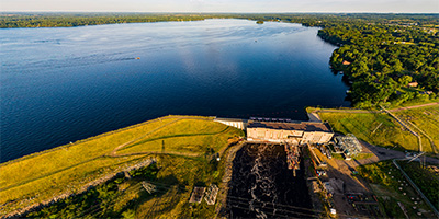
 360 degree panorama of the Black Dog Generating Plant on the Minnesota River in Burnsville, MN.
Equipment: DJI P4P, 24 mm
Categories: Industrial, Minnesota River, Quadcopter
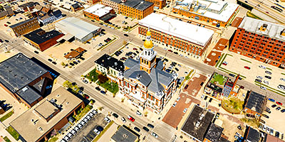
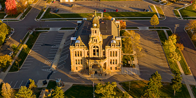 360 degree aerial panorama of the Historic Blue Earth County Courthouse in Mankato, MN.
Equipment: DJI P4P, 24 mm
Categories: Mankato, Quadcopter
 360 degree aerial panorama over the BNSF Midway Railroad Yard in South St. Anthony between Minneapolis and St. Paul.
Equipment: DJI P4P, 24 mm
Categories: Industrial, Minneapolis, Quadcopter, Railroads
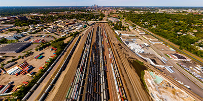
 360 degree aerial panorama directly over the BNSF Northtown Railroad Yard in Columbia Heights, just north of Minneapolis.
Equipment: DJI P4P, 24 mm
Categories: Industrial, Minneapolis, Quadcopter, Railroads
 360 degree aerial panorama over the BNSF Bridal Veil Railroad Yard Minneapolis, MN.
Equipment: DJI P4P, 24 mm
Categories: Industrial, Minneapolis, Quadcopter, Railroads
 360 degree aerial panorama at Bob Dylan's childhood home in Hibbing, MN. Look for the musical staff crosswalk at the intersection below, on Bob Dylan Drive, of course. Dylan's house is at the far end of the crosswalk. It's owned by Dylan superfan, archivist, and collector Bill Pagel who occasionally gives personal tours of the house. Really nice guy, stop and visit! Bill also runs the Dylan website boblinks.com
Equipment: DJI Air2s, 22 mm
Categories: Iron Range, Music, Quadcopter
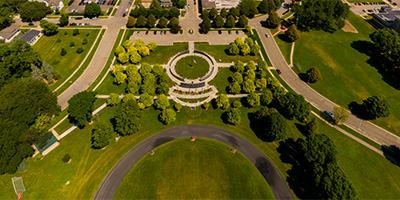
 Above Bridge Square with views of Ames Mill, Cannon River, Malt-O-Meal, and downtown Northfield, Minnesota.
Equipment: DJI P4P, 24 mm
Categories: Outstate Minnesota, Quadcopter
 360 degree aerial panorama above Broadway_Plaza in downtown Rochester, MN.
Equipment: DJI P4P, 24 mm
Categories: Quadcopter, Rochester
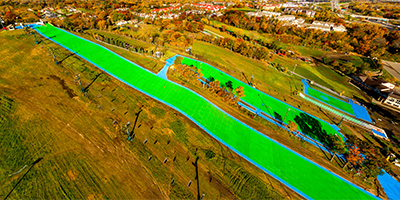 Buck Hill ski resort aerial. The green mats are for snowless skiing.
Equipment: DJI P3A, 20 mm
Categories: Quadcopter
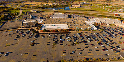
 360 degree aerial panorama over Burnsville Center in Burnsville, MN.
Equipment: DJI P3A, 20 mm
Categories: Quadcopter
 Aerial panorama of Burnsville Ice Center and The Garage.
Equipment: DJI P3A, 20 mm
Categories: Minneapolis, Quadcopter
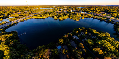
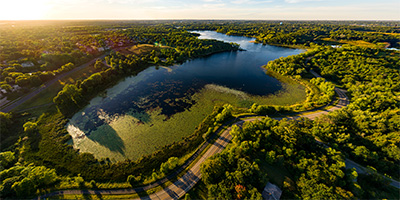 360 degree aerial panorama over Bush Lake in Bloomington, MN.
Equipment: DJI P4P, 24 mm
Categories: Minneapolis, Quadcopter
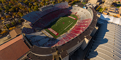 360 degree aerial panorama at Camp Randall Stadium in Madison, WI. (I saw the Rolling Stones here in 1994 on their Voodoo Lounge tour!)
Equipment: DJI P4P, 24 mm
Categories: Madison, Wisconsin, Quadcopter, Wisconsin
 Over the Little Cannon River near the confluence with the Cannon River in Cannon Falls, Minnesota.
Equipment: DJI P4P, 24 mm
Categories: Outstate Minnesota, Quadcopter
 360 degree aerial panorama over the Cannon River Trout Lily Scientific and Natural Area in Faribault, MN.
Equipment: 0, 24 mm
Categories: Outstate Minnesota, Quadcopter
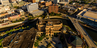
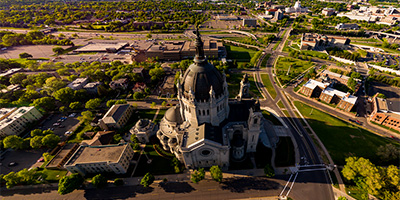 360 degree aerial panorama next to Cathedral of St. Paul in St. Paul, MN. Also visible is James J. Hill House and downtown St. Paul.
Equipment: DJI P3A, 20 mm
Categories: Quadcopter, Saint Paul
 360 degree aerial panorama above Riverfront Park in Chippewa Falls, WI.
Equipment: DJI P4P, 24 mm
Categories: Eau Claire OLD, Industrial, Quadcopter
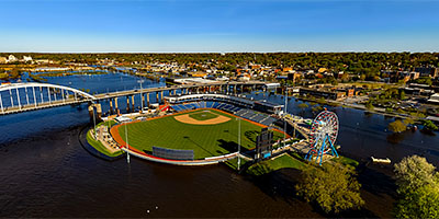
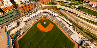 360 degree aerial panorama over CHS Field, home of the St. Paul Saints, in St. Paul, MN.
Equipment: DJI P3A, 20 mm
Categories: Quadcopter, Saint Paul
 360 degree aerial panorama at a church in Carlisle, IA
Equipment: DJI P4P, 24 mm
Categories: Iowa, Quadcopter
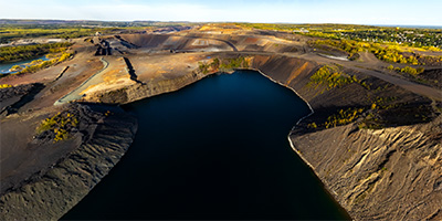
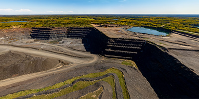 360 degree aerial panorama over an open-pit iron mine owned by Cleveland-Cliffs north of Gilbert, MN.
Equipment: DJI Air2s, 22 mm
Categories: Industrial, Iron Range, Quadcopter
 360 degree aerial panorama above Columbia Park and Columbia Golf Club in, Columbia Heights, MN.
Equipment: DJI P4P, 24 mm
Categories: Minneapolis, Quadcopter
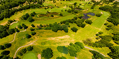
 Aerial panorama over Como Park Golf Course.
Equipment: DJI P3A, 20 mm
Categories: Como Zoo, Quadcopter, Saint Paul
 360 degree aerial panorama during sunset at the confluence of the St. Croix and Kinnickinnic rivers on the border of Minnesota and Wisconsin.
Equipment: DJI P4P, 24 mm
Categories: Quadcopter, St Croix River, Wisconsin
 Over the Mississippi River at Coon_Rapids_Dam.
Equipment: DJI P4P, 24 mm
Categories: Industrial, Mississippi River, Quadcopter
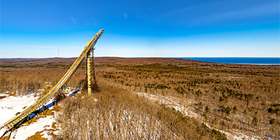 360 degree aerial panorama at Copper Peak Sky Jump in Bessemer, MI. Copper Peak is the largest ski jump in the world. Visitors can take an elevator to the top for the breathtaking view of the Upper Peninsula of Michigan, Lake Superior, the city of Ironwood, and Wisconsin.
Equipment: DJI Air2s, 22 mm
Categories: Quadcopter, Michigan U.P.
 Sunrise Over Cowles Commons in Downtown Des Moines, IA.
Equipment: DJI P3A, 20 mm
Categories: Iowa, Quadcopter
 Aerial panorama above Crossroads Center Aerial.
Equipment: DJI P3A, 20 mm
Categories: Quadcopter, Saint Cloud
 360 degree aerial panorama Iron County Courthouse in Crystal Fall , MI.
Equipment: DJI Air2s, 22 mm
Categories: Quadcopter, Michigan U.P.
 360 degree aerial panorama over the Davenport, IA Mississippi River floodgates.
Equipment: DJI Air2s, 22 mm
Categories: Iowa, Mississippi River, Quadcopter
 360 degree aerial panorama over Deardorff Orchard in Waconia, MN.
Equipment: DJI P4P, 24 mm
Categories: Apple Orchards, Quadcopter
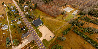
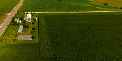
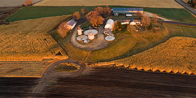
 360 degree aerial panorama over a farm in Denmark Township, MN.
Equipment: DJI P4P, 24 mm
Categories: Outstate Minnesota, Quadcopter
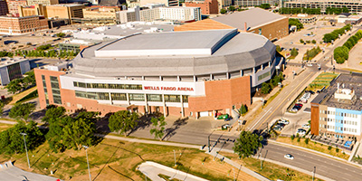 360 degree aerial panorama over the Des Moines River near the Wells Fargo Arena in downtown Des Moines, IA.
Equipment: DJI P4P, 24 mm
Categories: Iowa, Quadcopter
 360 degree aerial panorama above a deserted Rosedale Mall during the Covid19 lockdown in Roseville, MN. My submission to the Summer Solstice World Wide Panorama on the theme Confinment.
Equipment: DJI P4P, 24 mm
Categories: Minneapolis, Quadcopter, World Wide Panorama
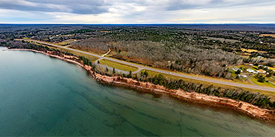
 360 degree aerial panorama at Diamond Bluff overlooking the Mississippi River in Diamond Bluff, WI. This was the site of one of the largest inland water catastrophes in the U.S. in 1890 when the Sea Wing, a steamboat built at the village of Diamond Bluff sank in a storm and killed 98 people.
Equipment: DJI P4P, 24 mm
Categories: Mississippi River, Quadcopter, Wisconsin
 360 degree aerial panorama at the Dubuque County Courthouse in Dubuque, IA.
Equipment: DJI Air2s, 22 mm
Categories: Iowa, Mississippi River, Quadcopter
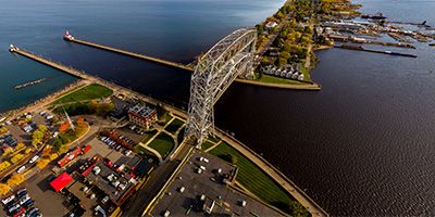 360 degree aerial panorama of Duluth Harbor and Aerial Lift Bridge.
Equipment: DJI P3A, 20 mm
Categories: Bridges, Duluth, Featured, Quadcopter
 360 degree aerial panorama over Dunlap Island Park on the St. Louis River in Cloquet, MN.
Equipment: DJI Air2s, 22 mm
Categories: Duluth, Iron Range, Quadcopter
 Earle Brown Heritage Center 360 degree aerial panorama, Brooklyn Center, MN.
Equipment: DJI P4P, 24 mm
Categories: Minneapolis, Quadcopter
 360 degree aerial panorama 400' over the east side of Lake Owasso in Shoreview, MN.
Equipment: DJI Air2s, 22 mm
Categories: Quadcopter, Shoreview
 Aerial panorama over the Nestle factory in Eau Claire, WI
Equipment: DJI P3A, 20 mm
Categories: Eau Claire OLD, Industrial, Quadcopter, Wisconsin
 360 degree aerial panorama at sunset from Elk Mound Park near Eau Claire, WI.
Equipment: DJI P4P, 24 mm
Categories: Eau Claire OLD, Quadcopter, Wisconsin
 360 degree aerial panorama over Emma Krumbee's Apple Orchard in Belle Plaine, MN.
Equipment: DJI P4P, 24 mm
Categories: Apple Orchards, Quadcopter
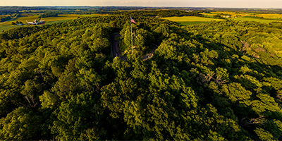
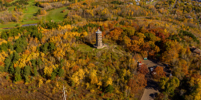 360 degree aerial panorama overlooking Lake Superior near Enger Tower in Duluth, MN.
Equipment: DJI P4P, 24 mm
Categories: Duluth, Quadcopter
 360 degree aerial panorama showing the Eveleth Hippodrome in Eveleth, MN.
Equipment: DJI Air2s, 22 mm
Categories: Iron Range, Quadcopter
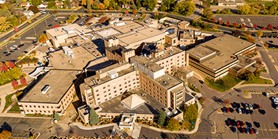
 Aerial panorama above Fairview Ridges Hospital.
Equipment: DJI P3A, 20 mm
Categories: Minneapolis, Quadcopter
 Fairy Falls sunrise 360 degree aerial panorama north of Stillwater, MN.
Equipment: DJI P4P, 24 mm
Categories: Quadcopter, St Croix River, Stillwater, World Wide Panorama
 360 degree aerial panorama over Fall Harvest Orchard at sunset in Montrose, MN.
Equipment: DJI P4P, 24 mm
Categories: Apple Orchards, Quadcopter
 360 degree aerial panorama over Fischer Croix Farm Orchard on the banks of the St. Croix River in Hastings, MN. Downstream to the south you can see the confluence of the St. Croix and Mississippi Rivers. In the distance to the southwest you can see the new Hastings Mississippi River Bridge and Ardent Mills on the bank of the Vermillion River.
Equipment: DJI P4P, 24 mm
Categories: Apple Orchards, Quadcopter, St Croix River
 360 degree aerial panorama at Fish Lake in Maple Grove, MN.
Equipment: DJI P4P, 24 mm
Categories: Maple Grove, Quadcopter
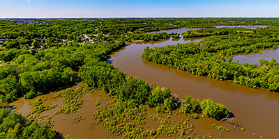
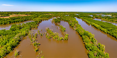 360 degree aerial panorama over Minnesota River Valley flooding near Blakeley, MN.
Equipment: DJI Air2s, 22 mm
Categories: Minnesota River, Quadcopter
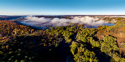 360 degree aerial panorama over a foggy St. Croix River Valley north of Osceola, WI.
Equipment: DJI P4P, 24 mm
Categories: Quadcopter, St Croix River, Wisconsin
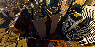
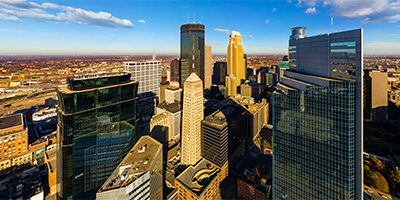 Foshay Tower from 10th St. 360 degree aerial panorama above downtown Minnepolis, MN.
Equipment: DJI P3A, 20 mm
Categories: Minneapolis, Quadcopter
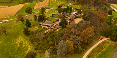 360 degree aerial panorama at Taliesin, Frank Lloyd Wright's home, studio, and 800 acre estate in Wisconsin.
Equipment: DJI P4P, 24 mm
Categories: Quadcopter, Wisconsin
 360 degree aerial panorama over St. Paul’s proposed soccer stadium site.
Equipment: DJI P3A, 20 mm
Categories: Quadcopter, Saint Paul
 Aerial panorama of Girl Scout Camp Sagata.
Equipment: DJI P3A, 20 mm
Categories: Quadcopter, St Croix River, Stillwater
 360 degree aerial panorama at sunrise from Mt. Zion Ski Hill overlooking Gogebic Community College in Ironwood, MI.
Equipment: DJI Air2s, 22 mm
Categories: Quadcopter, Michigan U.P.
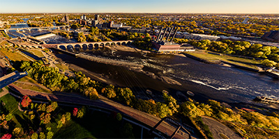 360 degree aerial panorama directly over Gold Medal Park overlooking the Mississippi River in downtown Minnespolis, MN. The river has been drawn down to record levels to inspect the locks, exposing the river bottom in places, the exposed foot of St. Anthony Falls, and remains of older river structures.
Equipment: DJI P4P, 24 mm
Categories: 35W Bridge Collapse, Minneapolis, Mississippi River, Quadcopter, World Wide Panorama
 360 degree aerial panorama above Gooseberry Falls north of Duluth, MN.
Equipment: DJI P3A, 20 mm
Categories: Duluth, Quadcopter
 Granite Falls and Minnesota River 360 degree aerial panorama in Granite Falls, MN.
Equipment: DJI P4P, 24 mm
Categories: Industrial, Minnesota River, Outstate Minnesota, Quadcopter
 Over Hamline University in St. Paul, Minnesota
Equipment: DJI P4P, 24 mm
Categories: Quadcopter, Saint Paul
 360 degree aerial panorama above Hansen Park in New Brighton, MN,
Equipment: DJI P4P, 24 mm
Categories: Minneapolis, Quadcopter
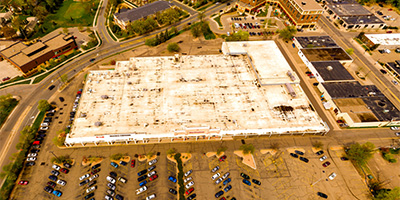
 360 degree aerial panorama of HarMar Mall in Roseville, MN.
Equipment: DJI P3A, 20 mm
Categories: Quadcopter, Roseville
 360 degree aerial panorama over Harriet Alexandar Nature Center in Roseville, Minnesota.
Equipment: DJI P3A, 20 mm
Categories: Quadcopter, Roseville
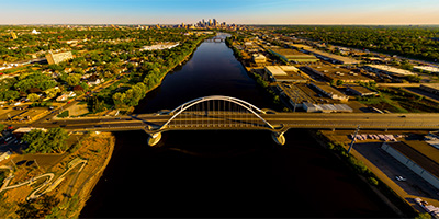
 Mississippi River bridge at Hastings, MN.
Equipment: DJI P4P, 24 mm
Categories: Bridges, Mississippi River, Quadcopter
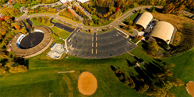
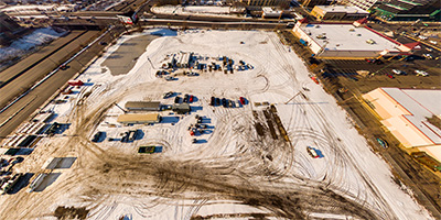
 360 degree aerial panorama of the Anoka State Hospital complex, long rumored to be the most haunted place in Minnesota.
(Although I certainly don't believe that crap.)
360 degree aerial panorama of the Anoka State Hospital complex, long rumored to be the most haunted place in Minnesota.
(Although I certainly don't believe that crap.)
Equipment: DJI P4P, 24 mm
Categories: Different, Quadcopter
 HealthEast Sports Center 360 degree aerial panorama, Woodbury, MN.
Equipment: DJI P4P, 24 mm
Categories: Quadcopter
 360 degree aerial panorama over flooded farmland on the Minnesota River in Henderson, MN. Haze due to wildfires in Canada.
Equipment: DJI Air2s, 22 mm
Categories: Bridges, Minnesota River, Outstate Minnesota, Quadcopter
 360 degree aerial panorama over flooded farmland on the Minnesota River in Henderson, MN. Alternate version using NO Dehaze.
Equipment: DJI Air2s, 22 mm
Categories: Bridges, Minnesota River, Outstate Minnesota, Quadcopter
 360 degree aerial panorama above Hennepin County Government Center in downtown Minnepolis, MN.
Equipment: DJI P3A, 20 mm
Categories: Minneapolis, Quadcopter
 360 degree aerial panorama over the Hibbing City Memorial Building in Hibbing, MN.
Equipment: DJI Air2s, 22 mm
Categories: Iron Range, Quadcopter
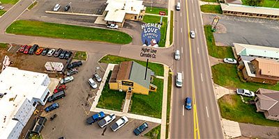 360 degree aerial panorama at Higher Love Cannabis Dispensary in Ironwood, MI. Only a four hour drive from Minneapolis, unless you keep your drone in the back seat and have to stop every half hour to fly!
Equipment: DJI Air2s, 22 mm
Categories: Ironwood, Quadcopter, Michigan U.P.
 360 degree aerial panorama over the Hill of Three Waters north of Hibbing, MN. This is one of five intersections of continental divides in the U.S., where water drains to three different watersheds. This is the intersection of the Northern Divide with the St. Lawrence Seaway Divide. From this point water flows north to the Hudson Bay, south to the Gulf of Mexico, and east to the Gulf of St. Lawrence. Chippewa Indians held important council meetings here at "The Top of the World".
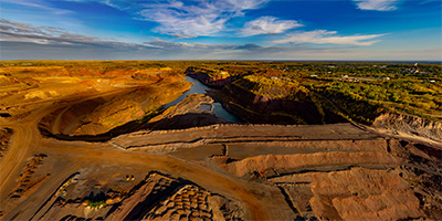
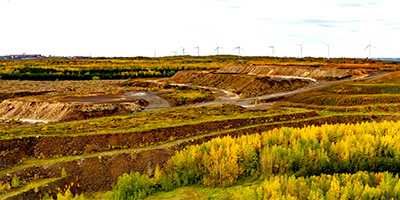
Now this is the HullRustMahoning Open Pit Iron Mine, which is the largest open-pit iron mine in the world, stretching over three miles long, two miles wide, and 535 feet deep.
360 degree aerial panorama over the Hill of Three Waters north of Hibbing, MN. This is one of five intersections of continental divides in the U.S., where water drains to three different watersheds. This is the intersection of the Northern Divide with the St. Lawrence Seaway Divide. From this point water flows north to the Hudson Bay, south to the Gulf of Mexico, and east to the Gulf of St. Lawrence. Chippewa Indians held important council meetings here at "The Top of the World".
Now this is the HullRustMahoning Open Pit Iron Mine, which is the largest open-pit iron mine in the world, stretching over three miles long, two miles wide, and 535 feet deep.
Equipment: DJI Air2s, 22 mm
Categories: Featured, Industrial, Iron Range, Quadcopter
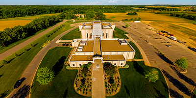 Aerial panorama above the Hindu Temple of Minnesota in Maple Grove.
Equipment: DJI P4P, 24 mm
Categories: Quadcopter
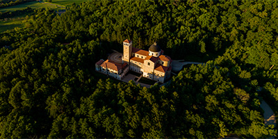
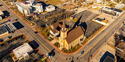 360 degree aerial panorama over Holy Spirit Catholic Church, Menomoniee, MI.
Equipment: DJI Air2s, 22 mm
Categories: Quadcopter, Michigan U.P.
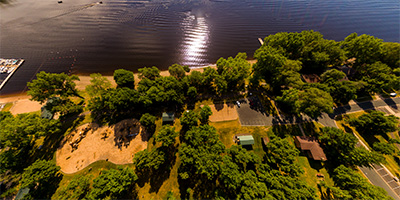
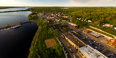 360 degree aerial panorama over Hudson Lakefront Park in Hudson, WI.
Equipment: DJI P3A, 20 mm
Categories: Quadcopter, St Croix River, Wisconsin
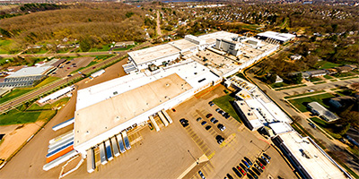
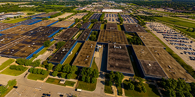 360 degree aerial panorama above the IBM factory in Rochester, MN. When I first moved to Minneapolis in 1988 I interviewed for a programming job on the new AS/400 midrange computer which was manufactured at this factory.
Equipment: DJI P4P, 24 mm
Categories: Industrial, Quadcopter, Rochester
 360 degree aerial panorama over Ice Lake, near Lakeshore Motel, in Iron River, MI. Hi Bonnie, I told you I'd do a cool 360 for you!)
Equipment: DJI Air2s, 22 mm
Categories: Quadcopter, Michigan U.P.
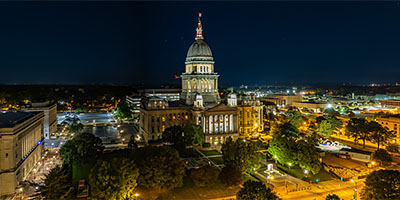 360 degree aerial panorama at night at the Illinois State Capitol in Springfield, IL. Massive four year construction project, but shooting this side and at night covered it up well.
Equipment: DJI Air2s, 22 mm
Categories: State Capitols, Quadcopter
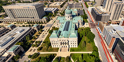 360 degree aerial panorama at the Indiana State Capitol in Indianopolis, IN.
Equipment: DJI Air2s, 22 mm
Categories: State Capitols, Quadcopter
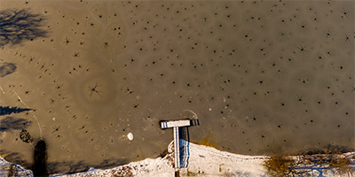 360 degree aerial panorama above an invasion of giant Ice Spiders on Lake Josephine in Roseville, Minnesota. These monsters must have hitched a ride on a meteor that crashed into the lake - they’re obviously not from earth.
This is actually a phenomenon caused by the weight of the snow forcing water to drain upward through the ice sheet. The dendrite formation is often called an ice spider, ice octopus, or ice star.
This was my second aerial panorama from my quadcopter.
Equipment: DJI P3A, 20 mm
Categories: Quadcopter, Roseville
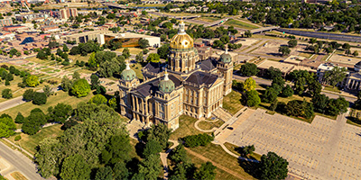 360 degree aerial panorama east of the Iowa State Capitol in Des Moines, IA.
Equipment: DJI P4P, 24 mm
Categories: State Capitols, Iowa, Quadcopter
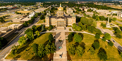 360 degree aerial panorama at sunset over the historic Iowa State Capitol in Des Moines, IA. Building construction completed in 1886 but the conversion of gas lights to electric in 1904 caused a fire requiring major restoration. In the 1980s the Capitol exterior had deteriorated, with sandstone chunks falling from the building, requiring a nine phase restoration project that completed in 1998.
This is my submission to the World Wide Panorama event History (revisited).
https://worldwidepanorama.org/wwp621/
360 degree aerial panorama at sunset over the historic Iowa State Capitol in Des Moines, IA. Building construction completed in 1886 but the conversion of gas lights to electric in 1904 caused a fire requiring major restoration. In the 1980s the Capitol exterior had deteriorated, with sandstone chunks falling from the building, requiring a nine phase restoration project that completed in 1998.
This is my submission to the World Wide Panorama event History (revisited).
https://worldwidepanorama.org/wwp621/
Equipment: DJI P4P, 24 mm
Categories: State Capitols, Iowa, Quadcopter, World Wide Panorama
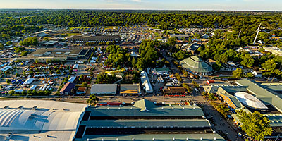 360 degree aerial panorama of the Iowa State Fair from over the Sheep Barn. Prettier than it sounds!
Equipment: DJI Air2s, 22 mm
Categories: Iowa, Quadcopter
 360 degree aerial panorama at the Iron Trail Motors Event Center in Virginia, MN.
Equipment: DJI Air2s, 22 mm
Categories: Iron Range, Quadcopter
 Irvine Park Zoo 360 degree aerial panorama.
Equipment: DJI P4P, 24 mm
Categories: Eau Claire OLD, Quadcopter, Wisconsin
 360 degree aerial panorama at sunset over Island Lake Park in Shoreview, MN.
Equipment: DJI Air2s, 22 mm
Categories: Quadcopter, Shoreview
 360 degree aerial panorama of Island Resort and Casino, Hannahville. MI.
Equipment: DJI Air2s, 22 mm
Categories: Quadcopter, Michigan U.P.
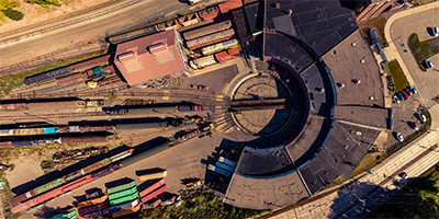 360 degree aerial panorama over the Jackson Street Roundhouse, which is the headquarters for the Minnesota Transportation Museum in St. Paul, MN and a working railroad roundhouse, one of the last of its kind in the country. Built in 1907 to replace an older roundhouse, the site has been used for rail transportation since the first railroad came to Minnesota in the 1860s.
Equipment: DJI P4P, 24 mm
Categories: Industrial, Quadcopter, Railroads, Saint Paul
 360 degree aerial panorama of Jim Falls, WI.
Equipment: DJI P4P, 24 mm
Categories: Eau Claire OLD, Industrial, Quadcopter
 360 degree aerial panorama at the Julien Dubuque Bridge over the Mississippi River in Dubuque, IA.
Equipment: DJI Air2s, 22 mm
Categories: Iowa, Mississippi River, Quadcopter
 Keg and Case Market/Schmidt Brewery Building in Saint Paul, MN.
Equipment: DJI P4P, 24 mm
Categories: Mississippi River, Quadcopter, Saint Paul
 Aerial panorama of Keller Regional Park, Keller Lake, and Keller Golf Course.
Equipment: DJI P3A, 20 mm
Categories: Quadcopter, Saint Paul
 360 degree aerial panorama above the Krech Farm Canon Falls MN.
Equipment: DJI P4P, 24 mm
Categories: Outstate Minnesota, Quadcopter
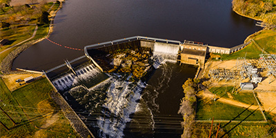 Above the Lake Byllesby Dam on the Cannon River near Cannon Falls, Minnesota.
Equipment: DJI P4P, 24 mm
Categories: Industrial, Outstate Minnesota, Quadcopter
 Lake De Montreville 360 degree aerial panorama. For over 20 years every time Id drive to Stillwater Id see a street sign for DEMONTREVILLE TRAIL. I lived in New Orleans long enough to figure out the correct pronunciation, but in my head I always think DEMON TREE VILLE. Now Ive even got my grandkids wondering if the road leads to a small village with a Demon Tree in the middle of it. Or MANY Demon Trees! Or perhaps it has houses built with the wood from Demon Trees. And doesnt Demon Tree sound like the perfect name for a heavy metal band?!
Equipment: DJI P4P, 24 mm
Categories: Quadcopter
 360 degree aerial panorama above Lake Gervais in Little Canada, MN.
Equipment: DJI P3A, 20 mm
Categories: Quadcopter
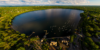 360 degree aerial panorama over the Lake Harriet Bandshell in Minneapolis, MN.
Equipment: DJI P4P, 24 mm
Categories: Minneapolis, Quadcopter
 360 degree aerial panorama over Lake Ore-be-gone in Gilbert, MN. This is a 140 acre lake formed by the flooding of three open-pit iron ore mines. The name is a pun on the well-known Minnesota fictional town of Lake Wobegon, which is what made me notice it on the map and go shoot this panorama. Whoever named this should get an award for humor and creativity. Regardless of the Lake Wobegone pun, it is SO PERFECTLY DESCRIPTIVE. All the ore be gone!
Equipment: DJI Air2s, 22 mm
Categories: Iron Range, Quadcopter
 360 degree aerial panorama over Lake Owasso in Shoreview, MN.
Equipment: DJI P3A, 20 mm
Categories: Quadcopter, Shoreview
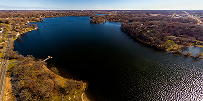
 360 degree aerial panorama of Lake Phalen in St. Paul, MN.
Equipment: DJI P3A, 20 mm
Categories: Quadcopter, Saint Paul
 Over Lake Valentine next to Bethel University in Arden Hills, Minnesota
Equipment: DJI P4P, 24 mm
Categories: Quadcopter, Shoreview
 360 degree aerial panorama of Lake Wissota Hydroelectric Plant, Chippewa Falls, WI.
Equipment: DJI P4P, 24 mm
Categories: Eau Claire OLD, Industrial, Quadcopter
 360 degree aerial panorama at Lakeshore Motel on Ice Lake near Iron River, MI.
Equipment: DJI Air2s, 22 mm
Categories: Quadcopter, Michigan U.P.
 360 degree aerial panorama of the corporate headwarters of Land O' Lakes in Arden Hills, MN.
Equipment: DJI P4P, 24 mm
Categories: Quadcopter, Shoreview
 360 degree aerial panorama above the Laura Ingalls Wilder Museum in Pepin, WI, along the Mississippi River and Lake Pepin, WI.
Equipment: DJI P4P, 24 mm
Categories: La Crosse, Mississippi River, Quadcopter, Wisconsin
 360 degree aerial panorama near the Laurentian Divide which separates the watershed of the Atlantic Ocean from the Hudson Bay watershed. I think the line of wind turbines on the ridge are the actual Laurentian Divide, but we couldnt get any closer. Mining company guards stopped us from one direction, this is the closest we could get from the other direction in our little Toyota Corrolla.
Equipment: DJI Air2s, 22 mm
Categories: Iron Range, Quadcopter
 360 degree aerial panorama upriver from the Quad Cities at Le Claire, IA, over a flooded Mississippi River.
Equipment: DJI Air2s, 22 mm
Categories: Iowa, Mississippi River, Quadcopter
 360 degree aerial panorama over flooded Mississippi River near LeClaire Park and Bandshell in downtown Davenport, IA.
Equipment: DJI Air2s, 22 mm
Categories: Iowa, Mississippi River, Quadcopter
 360 degree aerial panorama over the lake that Leonidas Overlook "overlooks".
Equipment: DJI Air2s, 22 mm
Categories: Iron Range, Quadcopter
 360 degree aerial panorama of Lexington Plaza Shoppes in Roseville, MN.
Equipment: DJI P4P, 24 mm
Categories: Quadcopter, Roseville
 360 degree aerial panorama over Lost Valley Prairie Scientific and Natural Area between the Mississippi River and the St. Croix River in Cottage Grove, MN.
Equipment: DJI P4P, 24 mm
Categories: Quadcopter, St Croix River
 Over the Mississippi River near the Lowry Avenue Bridge in Minneapolis, Minnesota
Equipment: DJI P4P, 24 mm
Categories: Bridges, Minneapolis, Mississippi River, Quadcopter
 360 degree aerial panorama over LuceLine Orchard in Watertown, MN.
Equipment: DJI P4P, 24 mm
Categories: Apple Orchards, Quadcopter
 360 degree aerial panorama near Lume Recreational Cannabis, Menomoniee, MI.
Equipment: DJI Air2s, 22 mm
Categories: Quadcopter, Michigan U.P.
 Above the Magellan Pipeline/Tank Farm in Roseville, MN.
Equipment: DJI P4P, 24 mm
Categories: Industrial, Quadcopter
 360 degree aerial panorama at Maiden Rock Bluff in Wisconsin along the Mississippi River.
Equipment: DJI P4P, 24 mm
Categories: Mississippi River, Quadcopter, Wisconsin
 360 degree aerial panorama of Maple Grove Crossing, Maple Grove, MN.
Equipment: DJI P4P, 24 mm
Categories: Maple Grove, Quadcopter
 360 degree aerial panorama above Rice Lake in Maple Grove, MN.
Equipment: DJI P4P, 24 mm
Categories: Maple Grove, Quadcopter
 360 degree aerial panorama over Maplewood Community Center in Maplewood, MN.
Equipment: DJI P3A, 20 mm
Categories: Quadcopter, Saint Paul
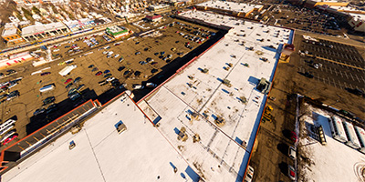
 360 degree aerial panorama of Maplewood Mall in Maplewood, MN.
Equipment: DJI P3A, 20 mm
Categories: Quadcopter, Saint Paul
 360 degree aerial panorama at Marinette Inn, Marinette, WI. A freebie because the desk clerk greeted me so nicely late Thanksgiving night, waiting at the door with my key in his hand and a smile on his face.
Equipment: DJI Air2s, 22 mm
Categories: Quadcopter, Michigan U.P.
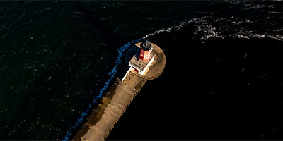
 360 degree aerial panorama at Marquette Harbor Lighthouse, Marquette, MI.
Equipment: DJI Air2s, 22 mm
Categories: Quadcopter, Michigan U.P.
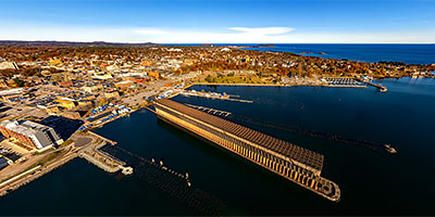 360 degree aerial panorama at Marquette Lower Harbor Ore Docks, Marquette, MI.
Equipment: DJI Air2s, 22 mm
Categories: Quadcopter, Michigan U.P.
 360 degree aerial panorama above Marquette Mountain Resort, Marquette, MI.
Equipment: DJI Air2s, 22 mm
Categories: Quadcopter, Michigan U.P.
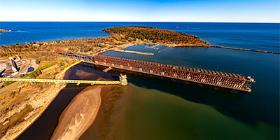 360 degree aerial panorama at Marquette Upper Harbor Ore Docks, Marquette, MI.
Equipment: DJI Air2s, 22 mm
Categories: Quadcopter, Michigan U.P.
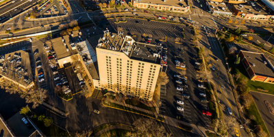
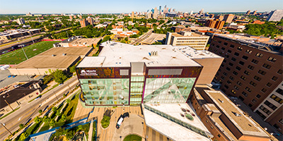 University of Minnesota Masonic Childrens Hospital.
Equipment: DJI P3A, 20 mm
Categories: Minneapolis, Quadcopter
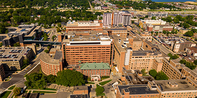
 360 degree aerial panorama at the Mankate Mayo Clinic in Mankato, MN.
Equipment: DJI P4P, 24 mm
Categories: Mankato, Quadcopter
 360 degree aerial panorama over Pill Hill, near the Mayo Clinic Hospital, Saint Marys Campus in Rochester, MN.
Equipment: DJI P4P, 24 mm
Categories: Quadcopter, Rochester
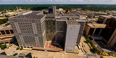 360 degree aerial panorama in front of the Mayo Clinic in downtown Rochester, MN.
Equipment: DJI P4P, 24 mm
Categories: Quadcopter, Rochester
 360 degree aerial panorama above McDougalls Apple Junction along the St. Croix River north of Hastings, MN.
Equipment: DJI P4P, 24 mm
Categories: Apple Orchards, Quadcopter, St Croix River
 360 degree aerial panorama Medina Entertainment Center in Medina, MN. Great venue - I've seen Blue Oyster Cult here a bunch of times!
Equipment: DJI P4P, 24 mm
Categories: Quadcopter
 360 degree aerial panorama above Menomoniee Lighthouse, Menomoniee, MI.
Equipment: DJI Air2s, 22 mm
Categories: Quadcopter, Michigan U.P.
 360 degree aerial panorama above Merle Hay Mall in Des Moines, IA.
Equipment: DJI P4P, 24 mm
Categories: Iowa, Quadcopter
 360 degree aerial panorama at Meyer Farm in Denmark Township, MN.
Equipment: DJI P4P, 24 mm
Categories: Outstate Minnesota, Quadcopter
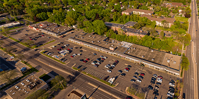
 Micro Center Computers in St. Louis Park
Equipment: DJI P4P, 24 mm
Categories: Minneapolis, Quadcopter
 360 degree aerial panorama over Midway Shopping Center just north of the future site of the St. Paul soccer stadium.
This was my first aerial panorama with a quadcopter. I’ve chartered helicopters that cost more for one hour than it cost to buy my own drone!
Equipment: DJI P3A, 20 mm
Categories: Quadcopter, Saint Paul
 360 degree aerial panorama of the North Loop in Minneapolis, MN.
Equipment: DJI Air2s, 22 mm
Categories: Minneapolis, Quadcopter
 360 degree aerial panorama over Minnesota Harvest Craft Cider Bar and Orchard in Jordan, MN.
Equipment: DJI P4P, 24 mm
Categories: Apple Orchards, Quadcopter
 360 degree aerial panorama over flooded Minnesota River near Carver Riverside Park in Carver, MN.
Equipment: DJI Air2s, 22 mm
Categories: Minnesota River, Quadcopter
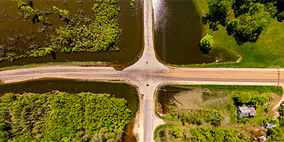 360 degree aerial panorama over a flooded intersection near the Minnesota River in Blakeley, MN.
Equipment: DJI Air2s, 22 mm
Categories: Bridges, Minnesota River, Outstate Minnesota, Quadcopter
 360 degree aerial panorama directly over the Wold Fair Fountain at Minnesota State University - Mankato.
Equipment: DJI P4P, 24 mm
Categories: Mankato, Quadcopter
 360 degree aerial panorama over Minnesota Valley State Recreation Area in Jordan, MN.
Equipment: DJI P4P, 24 mm
Categories: Minnesota River, Outstate Minnesota, Quadcopter
 360 degree aerial panorama over the Minnesota Zoo on a sunny summer morning in Apple Valley, MN.
Equipment: DJI P4P, 24 mm
Categories: Quadcopter

 360 degree aerial panorama over the MN United Soccer Stadium in St. Paul.7
Equipment: DJI P4P, 24 mm
Categories: Quadcopter, Saint Paul
 360 degree aerial panorama over flooded Mississippi River near Modern Woodmen Park in Davenport, IA.
Equipment: DJI Air2s, 22 mm
Categories: Featured, Iowa, Mississippi River, Quadcopter
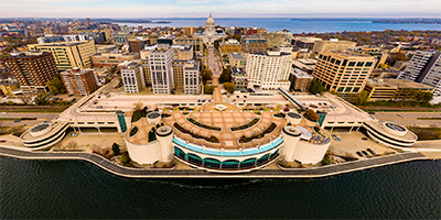 360 degree aerial panorama over Lake Monona at the Monona Terrace Convention Center in Madison, WI.
Equipment: DJI P4P, 24 mm
Categories: Madison, Wisconsin, Quadcopter, Wisconsin
 360 degree aerial panorama above Minnesota's Moose Lake State Park.
Equipment: DJI P4P, 24 mm
Categories: Duluth, Outstate Minnesota, Quadcopter
 360 degree aerial panorama over 400' above the scenic overlook at Mt. Marquette, Marquette, MI.
Equipment: DJI Air2s, 22 mm
Categories: Quadcopter, Michigan U.P.
 360 degree aerial panorama at Mt. Zion Ski Hill in Ironwood, MI, a popular destination for skiing and snowboarding enthusiasts in the western Upper Peninsula of Michigan near Gogebic Community College.
Equipment: DJI Air2s, 22 mm
Categories: Quadcopter, Michigan U.P.
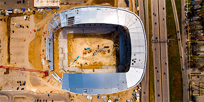
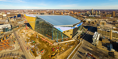 360 degree aerial panorama of the 90% complete Vikings Stadium in downtown Minneapolis, MN.
Equipment: DJI P3A, 20 mm
Categories: Minneapolis, Quadcopter
 360 degree aerial panorama at Normandale Lake / Hyland Hills Ski Area in Bloomington, MN,
Equipment: DJI P4P, 24 mm
Categories: Minneapolis, Quadcopter
 North of the Lowry Avenue Bridge over the Mississippi River in Minneapolis, Minnesota
Equipment: DJI P4P, 24 mm
Categories: Bridges, Minneapolis, Mississippi River, Quadcopter
 360 degree aerial panorama at Northern Light Cannabis Co, Sault Ste. Marie, MI.
Equipment: DJI Air2s, 22 mm
Categories: Quadcopter, Michigan U.P.
 360 degree aerial panorama above Northtown Mall in Blaine, MN.
Equipment: DJI P3A, 20 mm
Categories: Quadcopter
 360 degree aerial panorama above Olmsted County Government Center in downtown Rochester, MN.
Equipment: DJI P4P, 24 mm
Categories: Quadcopter, Rochester
 360 degree aerial panorama over Osceola Landing on the St. Croix River just south of Osceola, WI. We would usually pass this point while canoing and instead of getting out here we'd foolishly keep going to William O'Brien State Park and either miss the last bus back to Taylors Falls or have to paddle like crazy the last couple of miles.
Equipment: DJI P4P, 24 mm
Categories: Quadcopter, St Croix River
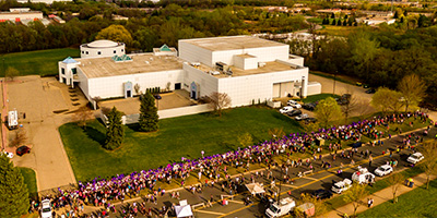 360 degree aerial panorama of Prince memorial at Paisley Park. The North and West fences were completly lined with notes, photos, various purple items, and hundreds of purple balloons.
Equipment: DJI P3A, 20 mm
Categories: Featured, Music, Prince Memorials, Quadcopter
 360 degree aerial panorama over Palmer Lake Park in Brooklyn Center, MN.
Equipment: DJI P4P, 24 mm
Categories: Quadcopter
 Aerial panorama over DoubleTree Park Place near I-394 and Hwy 100 in St. Louis Park, MN
Equipment: DJI P3A, 20 mm
Categories: Minneapolis, Quadcopter
 360 degree aerial panorama above Parkview Center School in Roseville, MN.
Equipment: DJI P3A, 20 mm
Categories: Quadcopter, Roseville
 360 degree aerial panorama above the site of the plane crash that killed Sen. Paul Wellstone, his wife, daughter, and several other people on October 25, 2002. The plane was flying slowly and too low as it approached the Eveleth airport, and according to NTSB records it crashed at the exact GPS coordinates below. I think the aviation term is CFIT - Controlled Flight Into Terrain.
Equipment: DJI Air2s, 22 mm
Categories: Iron Range, Quadcopter
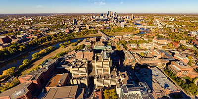 360 degree aerial panorama over the University of Minnesota at the Phillips-Wangensteen Building in Minneapolis, MN.
Equipment: DJI P4P, 24 mm
Categories: Minneapolis, Quadcopter, University of Minnesota
 360 degree aerial panorama over Pine Tree Apple Orchard just north of the Twin Cities, MN.
Equipment: DJI P4P, 24 mm
Categories: Apple Orchards, Quadcopter
 360 degree aerial panorama over Pleasant Valley Orchard near the St. Croix River at Osceola, WI.
Equipment: DJI P4P, 24 mm
Categories: Apple Orchards, Quadcopter, St Croix River, Wisconsin
 360 degree aerial panorama at the Plummer Building in downtown Rochester, MN.
Equipment: DJI P4P, 24 mm
Categories: Quadcopter, Rochester
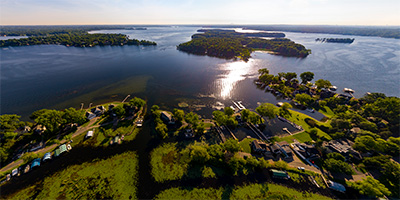
 360 degree aerial panorama at the Port of Excelsior in Excelsior, MN.
Equipment: DJI P4P, 24 mm
Categories: Quadcopter
 360 degree aerial panorama at Portage Canal Lift Bridge in Houghton, MI.
Equipment: DJI Air2s, 22 mm
Categories: Quadcopter, Michigan U.P.
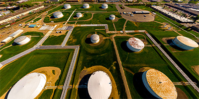
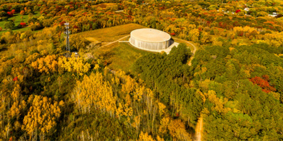
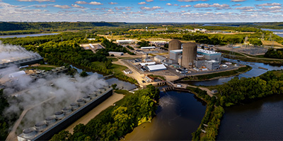 360 degree aerial panorama of the Prairie Island Nuclear Generating Plant near Red Wing, MN. This was my submission for the World Wide Panorama Equinox 2022 Climate Change theme. My first choice was to shoot a 360 of the control room interior, but after a month of trying unsuccessfully to get permission from Xcel I finally gave up. Surprisingly, I didn't need ANY permission to shoot from here.
Equipment: DJI Air2s, 22 mm
Categories: Industrial, Mississippi River, Quadcopter, World Wide Panorama
 360 degree aerial at Prairies Edge Casino Resort RV Park at sunrise in Granite Falls, MN.
Equipment: DJI P4P, 24 mm
Categories: Outstate Minnesota, Quadcopter
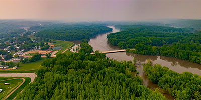
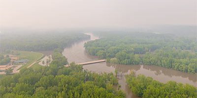
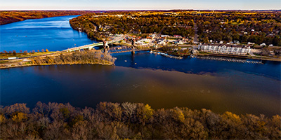 Prescott, Wisconsin, east of Hastings at the confluence of the Saint Croix River and the Mississippi River.
Equipment: DJI P4P, 24 mm
Categories: Mississippi River, Quadcopter, St Croix River
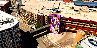 360 degree aerial panorama above First Avenue showing the Prince Mural.
Equipment: DJI P4P, 24 mm
Categories: Minneapolis, Music, Prince Memorials, Quadcopter
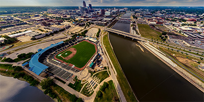 360 degree aerial panorama at Principal Park Baseball Stadium. Near the confluence of the Raccoon River and Des Moines River in Des Moines, IA.
Equipment: DJI P4P, 24 mm
Categories: Iowa, Quadcopter
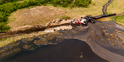
 360 degree aerial panorama from 400' above train derailment site in Raymond, MN.
Equipment: DJI Air2s, 22 mm
Categories: Industrial, Quadcopter, Railroads
 360 degree aerial panorama from 180' above train derailment site in Raymond, MN.
Equipment: DJI Air2s, 22 mm
Categories: Industrial, Quadcopter, Railroads
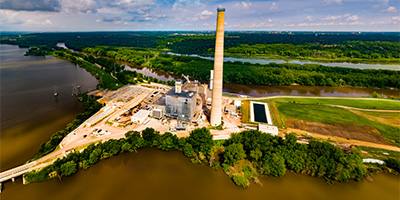
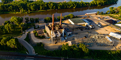 360 degree aerial panorama near Barn Bluff above the Xcel Generating Plant, which powers 50% of the homes in Red Wing, MN.
Equipment: DJI P4P, 24 mm
Categories: Industrial, Mississippi River, Quadcopter
 Memorial Park on Sorins Bluff, Red Wing, MN. 360 degree aerial panorama #2.
Equipment: DJI P3A, 20 mm
Categories: Mississippi River, Outstate Minnesota, Quadcopter
 Memorial Park on Sorins Bluff, Red Wing, MN. 360 degree aerial panorama #1.
Equipment: DJI P3A, 20 mm
Categories: Mississippi River, Outstate Minnesota, Quadcopter
 Aerial panorama above Reservoir Woods Park.
Equipment: DJI P3A, 20 mm
Categories: Quadcopter, Roseville, Saint Paul
 360 degree aerial panorama above Rice Creek near Chomonix Golf Course in Lino Lakes, MN. A woman in the cul de sac I launched from was very suspicious because she could not understand why anyone would want to take a photo of the lakes. She said she had livied there 16 years and didn't think the lake was very beautiful at all. I told her I had finished all the best lakes and now I was shooting second best lakes. :)
Equipment: DJI P4P, 24 mm
Categories: Quadcopter
 Over Rice Creek Chain Of Lakes Park Reserve in Lino Lakes, MN
Equipment: DJI P4P, 24 mm
Categories: Quadcopter
 360 degree aerial panorama over Ridgedale Center in Minnetonka, MN.
Equipment: DJI P3A, 20 mm
Categories: Quadcopter
 360 degree aerial panorama of River Hills Mall in Mankato, MN.
Equipment: DJI P4P, 24 mm
Categories: Mankato, Quadcopter
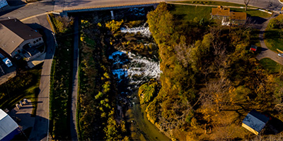
 360 degree aerial panorama above Junction Falls Dam on the Kinnickinnic River in River Falls, WI.
Equipment: DJI P4P, 24 mm
Categories: Quadcopter, Wisconsin
 360 degree aerial panorama over the Minnesota River at Riverfront Park and Vetter Stone Amphitheater in Mankato, MN
Equipment: DJI P4P, 24 mm
Categories: Mankato, Minnesota River, Quadcopter
 360 degree aerial panorama caddy-corner from Rize Recreational Cannabis Dispensary, and down the street from Higher Love Cannabis Co. in Ironwood, MI. Only FOUR HOURS drive from Minneapolis!!
Equipment: DJI Air2s, 22 mm
Categories: Featured, Quadcopter, Michigan U.P.
 360 degree aerial panorama at RIZE Cannabis, Menomoniee, MI.
Equipment: DJI Air2s, 22 mm
Categories: Quadcopter, Michigan U.P.
 360 degree aerial panorama at Robbinsdale Town Center in Robbinsdale, MN.
Equipment: DJI P4P, 24 mm
Categories: Quadcopter
 360 degree aerial panorama of Rochester Community and Technial College, Rochester Regional Sports Center, and the Rochester Baseball Complex in Rochester, MN.
Equipment: DJI P4P, 24 mm
Categories: Quadcopter, Rochester
 360 degree aerial panorama above Roselawn Cemetery near Reservoir Woods in Roseville, MN.
Equipment: DJI Air2s, 22 mm
Categories: Quadcopter, Roseville
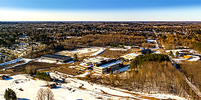
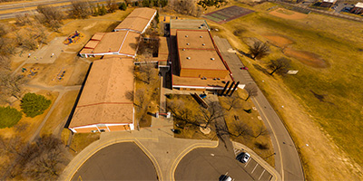
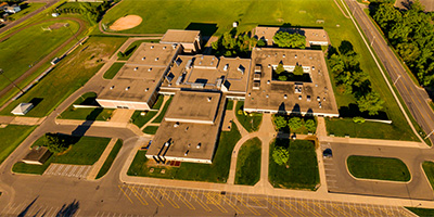
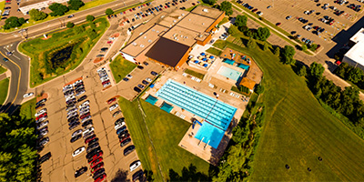
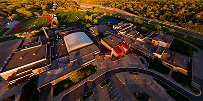 360 degree aerial panorama over Roseville Area High School (RAHS) in Roseville, MN.
Equipment: DJI P3A, 20 mm
Categories: Quadcopter, Roseville
 360 degree aerial panorama over Roseville Area Middle School (RAMS) in Roseville, MN.
Equipment: DJI P3A, 20 mm
Categories: Quadcopter, Roseville
 Aerial panorama over Roseville Central Park.
Equipment: DJI P3A, 20 mm
Categories: Quadcopter, Roseville
 360 degree aerial panorama over Roseville Valley Park in Roseville, MN.
Equipment: DJI P4P, 24 mm
Categories: Quadcopter, Shoreview
 360 degree aerial panorama over the Rouchleau Mine, east of Virginia, MN. The abandonded mine is now the source of Virginia Minnesota's drinking water.
Equipment: DJI Air2s, 22 mm
Categories: Industrial, Iron Range, Quadcopter
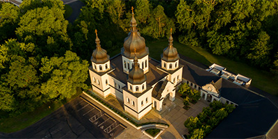 Saint Katherine Ukrainian Orthodox Church 360 degree aerial panorama.
Equipment: DJI P3A, 20 mm
Categories: Quadcopter, Shoreview
 360 degree aerial panorama at the High Bridge near downtown Saint Paul, MN.
Equipment: DJI P4P, 24 mm
Categories: Bridges, Mississippi River, Quadcopter, Saint Paul, World Wide Panorama
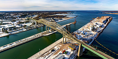 360 degree aerial panorama at Sault Ste. Marie International Bridge, Sault Ste. Marie, MI.
Equipment: DJI Air2s, 22 mm
Categories: Quadcopter, Michigan U.P.
 360 degree aerial panorama over Shoreview Shopping Center.
Equipment: DJI P3A, 20 mm
Categories: Quadcopter, Shoreview
 360 degree aerial panorama over the YMCA in Shoreview, MN.
Equipment: DJI P4P, 24 mm
Categories: Quadcopter, Shoreview
 360 degree aerial panorama above the Shrine of Our Lady of Guadalupe in La Crosse, WI.
Equipment: DJI P4P, 24 mm
Categories: La Crosse, Mississippi River, Quadcopter, Wisconsin
 Silverwood Park at Silver Lake, in St. Anthony, MN
Equipment: DJI P4P, 24 mm
Categories: Minneapolis, Quadcopter
 360 degree aerial panorama at Skidmore Bluff, WI, 800 feet above the Mississippi River near Hager City, WI. The bluff appeared in the 1922 movie Free Air in which a villain named Pinky driving a Model T roadster plunged off the bluff to his death.
Equipment: DJI P4P, 24 mm
Categories: Mississippi River, Quadcopter, Wisconsin
 360 degree aerial panorama above Soldiers Field Veterans Memorial in Rochester, MN.
Equipment: DJI P4P, 24 mm
Categories: Quadcopter, Rochester
 360 degree aerial panorama at Someset Village Hall on the Apple River in Somerset, Wisconsin.
Equipment: DJI P4P, 24 mm
Categories: Apple River, Quadcopter
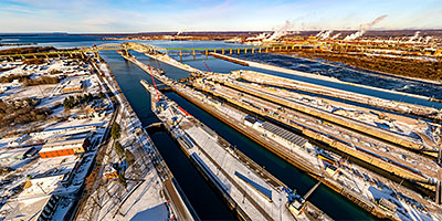 360 degree aerial panorama at Soo Locks, Sault Ste. Marie, MI.
Equipment: DJI Air2s, 22 mm
Categories: Quadcopter, Michigan U.P.
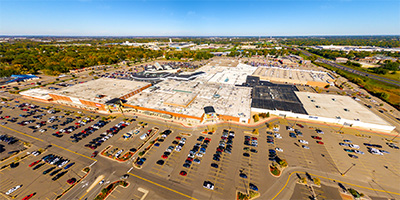
 360 degree aerial panorama of Southdale Center in Edina, MN.
Equipment: DJI P3A, 20 mm
Categories: Quadcopter
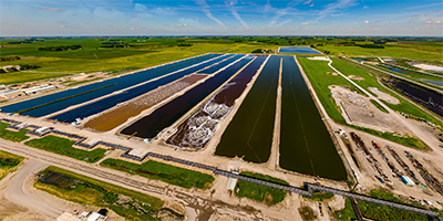 360 degree aerial panorama above the Southern Minnesota Beet Sugar Cooperative in Renville, MN.
Equipment: DJI P4P, 24 mm
Categories: Industrial, Outstate Minnesota, Quadcopter
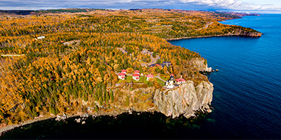 360 degree aerial panorama above Lake Superior near Minnesota's Split Rock Lighthouse State Park.
Equipment: DJI P4P, 24 mm
Categories: Duluth, Outstate Minnesota, Quadcopter
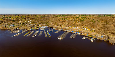
 Aerial panorama above Stillwater’s St Croix Boat and Packet Company
Equipment: DJI P3A, 20 mm
Categories: Quadcopter, St Croix River, Stillwater
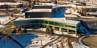
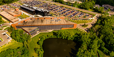
 Aerial panorama over the St Cloud Rivers Edge Convention Center.
Equipment: DJI P3A, 20 mm
Categories: Mississippi River, Quadcopter, Saint Cloud
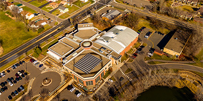
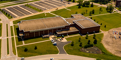
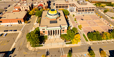
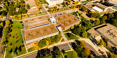 Aerial panorama of St. Cloud State University James Miller Learning Resources Center.
Equipment: DJI P3A, 20 mm
Categories: Quadcopter, Saint Cloud
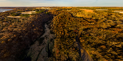 360 degree aerial panorama at sunrise over St. Croix Bluffs Regional Park along the St. Croix River betwee Minnesota and Wisconsin.
Equipment: DJI P4P, 24 mm
Categories: Quadcopter, St Croix River
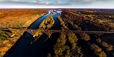
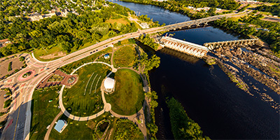
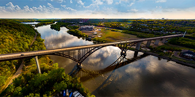
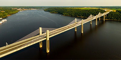 St. Croix Crossing aerial panorama from 380’.
Equipment: DJI P3A, 20 mm
Categories: Bridges, Quadcopter, St Croix River, Stillwater
 360 degree aerial panorama of St. Croix River flooding north of Stillwater, MN.
Equipment: DJI Air2s, 22 mm
Categories: Quadcopter, St Croix River, Stillwater
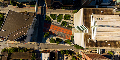
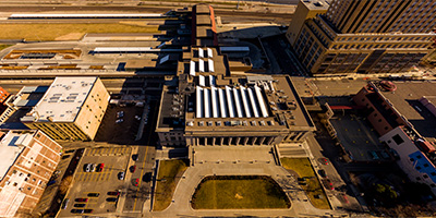 360 degree aerial panorama above the light rail at Union Depot in St. Paul, MN. This was my Spring Equinox 2016 submission to the World Wide Panorama on the theme Travel.
Equipment: DJI P3A, 20 mm
Categories: Quadcopter, Railroads, Saint Paul, Union Depot
 Aerial panorama at Stearns County Courthouse.
Equipment: DJI P3A, 20 mm
Categories: Quadcopter, Saint Cloud
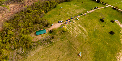 Aerial panorama over Stearns Scout Camp in New Haven, MN.
Equipment: DJI P3A, 20 mm
Categories: Outstate Minnesota, Quadcopter, Saint Cloud
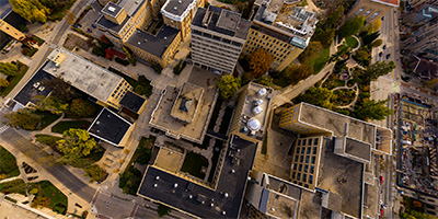 360 degree aerial panorama above the University of Wisconsin's Sterling Hall in Madison, WI.
Equipment: DJI P4P, 24 mm
Categories: Madison, Wisconsin, Quadcopter, University of Wisconsin, Wisconsin
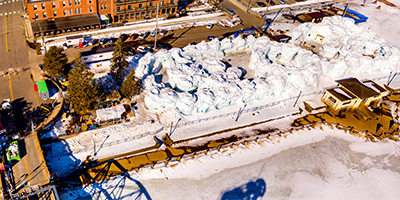 Stillwater Ice Castles 360 degree aerial panorama, from above the old lift bridge.
Equipment: DJI P4P, 24 mm
Categories: Quadcopter, St Croix River, Stillwater, World Wide Panorama
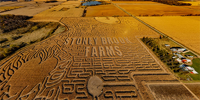 360 degree aerial panorama above the Stoney Brook Farms Corn Maze in Foley, MN.
Equipment: DJI Air2s, 22 mm
Categories: Quadcopter, Saint Cloud
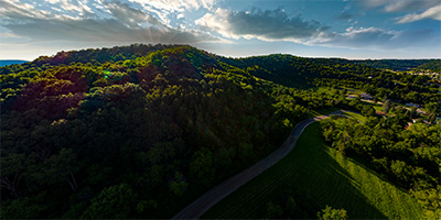 360 degree aerial panorama at Stoney Point in La Crescent, MN overlooking the Mississippi River.
Equipment: DJI P4P, 24 mm
Categories: La Crosse, Mississippi River, Quadcopter, Wisconsin
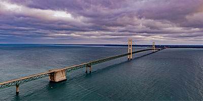 360 degree aerial panorama over the Straits of Mackinac near the Mackinac Bridge in Michigan.
Equipment: DJI Air2s, 22 mm
Categories: Quadcopter, Michigan U.P.
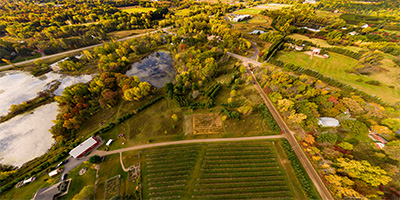 360 degree aerial panorama over Sunnybrook Apple Orchard in Stillwater, MN.
Equipment: DJI P4P, 24 mm
Categories: Apple Orchards, Quadcopter
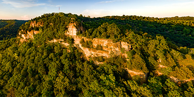 360 degree aerial panorama during sunset at Granddad Bluff. The 600-ft high bluff overlooks the city of La Crosse, Wisconsin. Wisconsin Trails readers voted this the most scenic view in the state.
Equipment: DJI P4P, 24 mm
Categories: La Crosse, Mississippi River, Quadcopter, Wisconsin
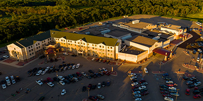 360 degree aerial panorama at sunset at Prairies Edge Casino in Granite Falls, MN.
Equipment: DJI P4P, 24 mm
Categories: Outstate Minnesota, Quadcopter
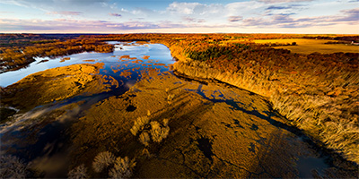 Sunset at the Apple River/Saint Croix River confluence.
Equipment: DJI P4P, 24 mm
Categories: Apple River, Quadcopter, St Croix River
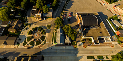 Above Surf Ballroom and Three Stars Plaza in Clear Lake, Iowa
Equipment: DJI P3A, 20 mm
Categories: Buddy Holly Crash Site, Iowa, Music, Quadcopter
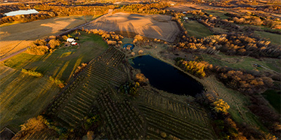 360 degree aerial panorama over Sweetland Orchard in Webster, MN.
Equipment: DJI P4P, 24 mm
Categories: Apple Orchards, Quadcopter

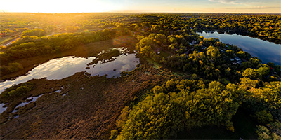 360 degree aerial panorama at sunset over Tamarack Park, just south of McCarrons Lake in Roseville, MN.
Equipment: DJI P4P, 24 mm
Categories: Quadcopter, Roseville
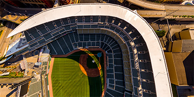 Over Target Field in downtown Minneapolis, MN, home of the Minnesota Twins baseball team.
Equipment: DJI P3A, 20 mm
Categories: Minneapolis, Quadcopter
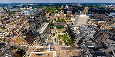 360 degree aerial panorama over the Minneapolis Central Library on Nicollet Mall in downtown Minneapolis during the 2023 Taste Of Minnesota.
Equipment: DJI Air2s, 22 mm
Categories: Minneapolis, Quadcopter
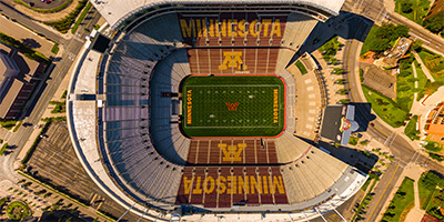 TCF Stadium at the University of Minnesota
Equipment: DJI P3A, 20 mm
Categories: Minneapolis, Quadcopter, University of Minnesota
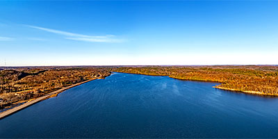 360 degree aerial panorama over Teal Lake in Negaunee, MI.
Equipment: DJI Air2s, 22 mm
Categories: Quadcopter, Michigan U.P.
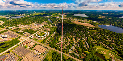 360 degree aerial panorama at the Telefarm Towers in Shoreview, MN. These are 1436' transmission towers for Twin Cities television stations WCCO, KSTP, KARE, and many radio stations. The towers were replacements for a tower that collapsed in 1971, killing six workers on the tower and one on the ground.
This is the highest altitude quadcopter aerial I've done so far. (It's also higher than all but one of my helicopter panoramas!) Normally 400' is the max alititude for a drone, but the FAA allows flights up to 400' HIGHER than nearby structures.
360 degree aerial panorama at the Telefarm Towers in Shoreview, MN. These are 1436' transmission towers for Twin Cities television stations WCCO, KSTP, KARE, and many radio stations. The towers were replacements for a tower that collapsed in 1971, killing six workers on the tower and one on the ground.
This is the highest altitude quadcopter aerial I've done so far. (It's also higher than all but one of my helicopter panoramas!) Normally 400' is the max alititude for a drone, but the FAA allows flights up to 400' HIGHER than nearby structures.
Equipment: DJI P4P, 24 mm
Categories: Industrial, Quadcopter, Shoreview
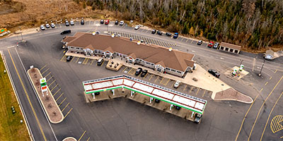 360 degree aerial panorama above The Fire Station Cannabis Co. Hannahville. MI.
Equipment: DJI Air2s, 22 mm
Categories: Fire Station Cannabis Co., Quadcopter, Michigan U.P.
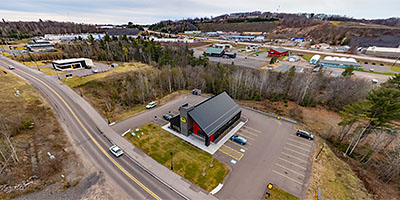 360 degree aerial panorama above The Fire Station Cannabis Co., Houghton, MI.
Equipment: DJI Air2s, 22 mm
Categories: Fire Station Cannabis Co., Quadcopter, Michigan U.P.
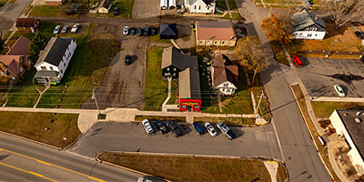 360 degree aerial panorama above The Fire Station Cannabis Co., Iron River, MI.
Equipment: DJI Air2s, 22 mm
Categories: Fire Station Cannabis Co., Quadcopter, Michigan U.P.
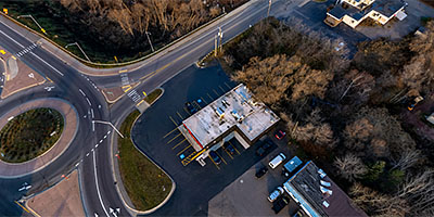 360 degree aerial panorama above The Fire Station Cannabis Co., Ishpeming, MI.
Equipment: DJI Air2s, 22 mm
Categories: Fire Station Cannabis Co., Quadcopter, Michigan U.P.
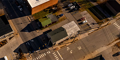 360 degree aerial panorama above The Fire Station Cannabis Co., Marquette, MI.
Equipment: DJI Air2s, 22 mm
Categories: Fire Station Cannabis Co., Quadcopter, Michigan U.P.
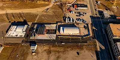 360 degree aerial panorama at The Fire Station Cannabis Co., Menomoniee, MI.
Equipment: DJI Air2s, 22 mm
Categories: Fire Station Cannabis Co., Quadcopter, Michigan U.P.
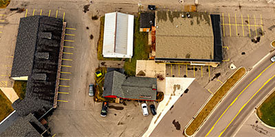 360 degree aerial panorama above The Fire Station Cannabis Co., Munising, MI.
Equipment: DJI Air2s, 22 mm
Categories: Fire Station Cannabis Co., Quadcopter, Michigan U.P.
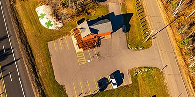 360 degree aerial panorama above The Fire Station Cannabis Co., Negaunee, MI.
Equipment: DJI Air2s, 22 mm
Categories: Fire Station Cannabis Co., Quadcopter, Michigan U.P.
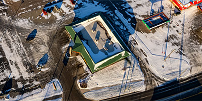 360 degree aerial panorama above The Fire Station Cannabis Co., Sault Ste. Marie, MI.
Equipment: DJI Air2s, 22 mm
Categories: Fire Station Cannabis Co., Quadcopter, Michigan U.P.
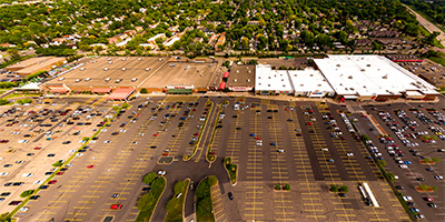 360 degree aerial panorama of the Quarry shopping center in Minneapolis, MN.
Equipment: DJI P3A, 20 mm
Categories: Minneapolis, Quadcopter
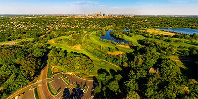 400' above Theodore Wirth Regional Park in Golden Valley, just west of Minneapolis, Minnesota.
Equipment: DJI P4P, 24 mm
Categories: Minneapolis, Quadcopter
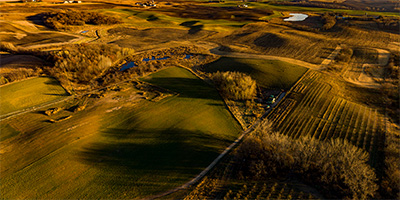 360 degree aerial panorama over Thompson's Hillcrest Orchard in Elko, MN.
Equipment: DJI P4P, 24 mm
Categories: Apple Orchards, Quadcopter
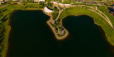 360 degree aerial panorama over West Arbor Lake at Town Green Park, Maple Grove, MN
Equipment: DJI P4P, 24 mm
Categories: Maple Grove, Quadcopter
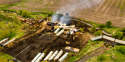 360 degree aerial panorama above Otter Creek in Sibley, Iowa after a train derailment.
Equipment: DJI P4P, 24 mm
Categories: Industrial, Iowa, Quadcopter, Railroads
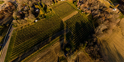 360 degree aerial panorama over Trumps Orchard in Faribault, MN.
Equipment: DJI P4P, 24 mm
Categories: Apple Orchards, Quadcopter
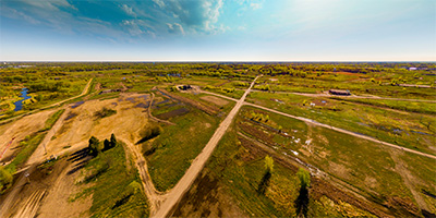 360 degree aerial panorama over Twin Cities Army Ammunition Plant in Mounds View, MN.
Equipment: DJI P3A, 20 mm
Categories: Quadcopter, Shoreview
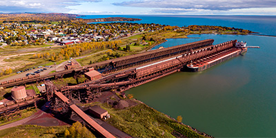 360 degree aerial panorama of the Iron Ore docks on Lake Superior's Agate Bay in Two Harbors, MN. The steel docks were originally built to load high grade iron ore from the Mesabi Iron Range onto large ships, but after World War II most of the high grade iron ore in the U.S. ran out and the industry moved to a lower grade ore, taconite, which you see here. The docks are over 1,300 feet long and seven stories tall. Today 12 million tons of taconite a year are shipped from Two Harbors to other locations on the Great Lakes eventually to be heated up to over 1000 degrees in blast furnaces, and converted into steel.
Equipment: DJI P4P, 24 mm
Categories: Duluth, Industrial, Outstate Minnesota, Quadcopter, World Wide Panorama
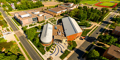 Aerial panorama of the Memorial Student Center on the U of W - Stout campus in Menomine, WI.
Equipment: DJI P3A, 20 mm
Categories: Quadcopter, University of Wisconsin, Wisconsin
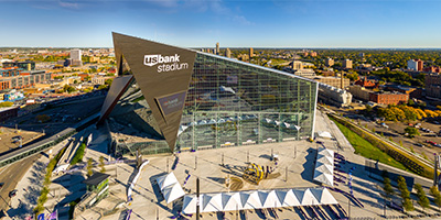 360 degree aerial panorama of the Viking’s U.S. Bank stadium, and location of Super Bowl 52 in downtown Minneapolis, MN.
Equipment: DJI P3A, 20 mm
Categories: Minneapolis, Quadcopter
 360 degree aerial panorama over the United Taconite Mine in Eveleth, MN.
Equipment: DJI Air2s, 22 mm
Categories: Industrial, Iron Range, Quadcopter
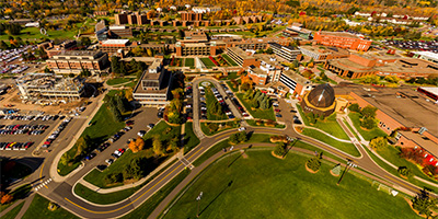 360 degree aerial panorama of the Duluth campus of the University of Minnesota.
Equipment: DJI P3A, 20 mm
Categories: Duluth, Quadcopter, University of Minnesota
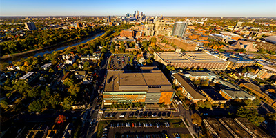 Aerial panorama over the University of Minnesota Health Clinics and Surgery Center in Minneapolis, MN.
Equipment: DJI P3A, 20 mm
Categories: Minneapolis, Quadcopter, University of Minnesota
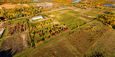 360 degree aerial panorama over University of Minnesota Horticultural Research Center Apple Orchard in Victoria, MN.
Equipment: DJI P4P, 24 mm
Categories: Apple Orchards, Quadcopter, University of Minnesota
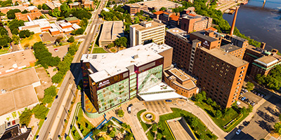 University of Minnesota Medical Center.
Equipment: DJI P3A, 20 mm
Categories: Minneapolis, Quadcopter
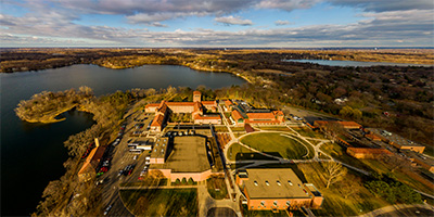 360 degree aerial panorama of University of Northwestern - St. Paul in Roseville, MN.
Equipment: DJI P3A, 20 mm
Categories: Quadcopter, Roseville
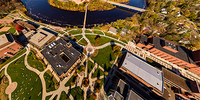 360 degree aerial panorama over the University of Wisconsin - Eau Claire.
Equipment: DJI P4P, 24 mm
Categories: Eau Claire OLD, Quadcopter, University of Wisconsin, Wisconsin
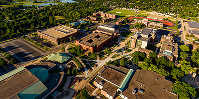 360 degree aerial panorama above the University of Wisconsin - La Crosse Campus, in La Crosse, WI.
Equipment: DJI P4P, 24 mm
Categories: La Crosse, Mississippi River, Quadcopter, University of Wisconsin, Wisconsin
 360 degree aerial panorama over University of Wisconsin - Superior.
Equipment: DJI Air2s, 22 mm
Categories: Duluth, Quadcopter, University of Wisconsin, Wisconsin
 360 degree aerial panorama over the University of Wisconsin at River Falls.
Equipment: DJI P4P, 24 mm
Categories: Quadcopter, University of Wisconsin, Wisconsin
 360 degree aerial panorama at the University of Wisconsin Health University Hospital in Madison, WI.
Equipment: DJI P4P, 24 mm
Categories: Madison, Wisconsin, Quadcopter, University of Wisconsin, Wisconsin
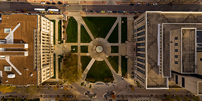 360 degree aerial panorama at the University of Wisconsin Library Mall in Madison, WI.
Equipment: DJI P4P, 24 mm
Categories: Madison, Wisconsin, Quadcopter, University of Wisconsin, Wisconsin
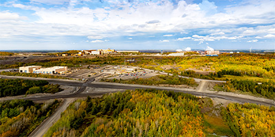 360 degree aerial panorama over US Steel Minntac in Mountain Iron, MN. Mountain Iron is the location of the first iron discovered in the area and helped make Minnesota the nations's largest iron producer and the United States the world's largest steel manufacturer.
Equipment: DJI Air2s, 22 mm
Categories: Industrial, Iron Range, Quadcopter
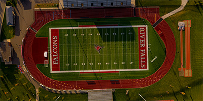 360 degree aerial panorama over the University of Wisconsin River Falls Falcon Stadium.
Equipment: DJI P4P, 24 mm
Categories: Quadcopter, University of Wisconsin, Wisconsin
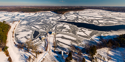 360 degree aerial panorama of Vadnais Lake in Vadnais Heights, Minnesota.
Equipment: DJI P3A, 20 mm
Categories: Quadcopter
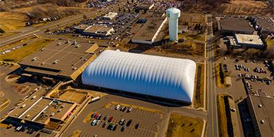 360 degree aerial panorama above Vadnais Sports Center in Vadnais Heights, MN.
Equipment: DJI P3A, 20 mm
Categories: Quadcopter, Shoreview
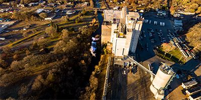 360 degree aerial panorama at Vermilion Falls in Hastings, MN.
Equipment: DJI P4P, 24 mm
Categories: Outstate Minnesota, Quadcopter
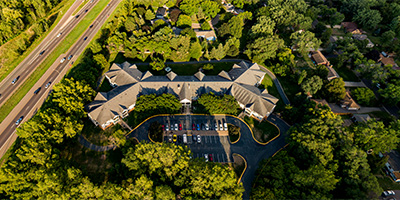 360 degree aerial panorama of Victoria Place Apartments in Roseville, MN.
Equipment: DJI P4P, 24 mm
Categories: Quadcopter, Roseville
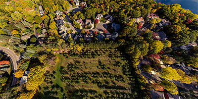 360 degree aerial panorama over Victoria Valley Orchard in Shoreview, MN.
Equipment: DJI P4P, 24 mm
Categories: Apple Orchards, Quadcopter, Shoreview
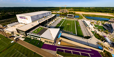 360 degree aerial panorama at the Minnesota Vikings Training Facility, Edina, MN.
Equipment: DJI P4P, 24 mm
Categories: Minneapolis, Quadcopter
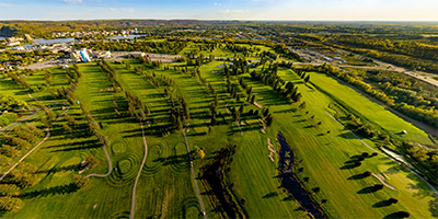 360 degree aerial panorama over the Virginia Golf Course in Virginia, MN
Equipment: DJI Air2s, 22 mm
Categories: Iron Range, Quadcopter
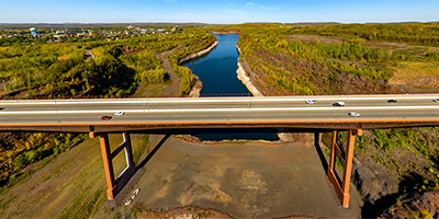 360 degree aerial panorama south of the Virginia High Bridge / Rouchleau Bridge / U.S. Hwy 53 Bridge / Rukavina Memorial Bridge / Mesabi Trail Brsidge. (I guess its's too impressive of a bridge to get by with just two or three names.) This is the tallest bridge in Minnesota.
Equipment: DJI Air2s, 22 mm
Categories: Bridges, Iron Range, Quadcopter
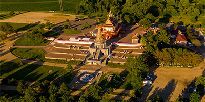 360 degree aerial panorama of Wat Munisotaram, a Cambodian Buddhist Temple in Hampton, MN, 30 miles south of Minneapolis. This is the largest Cambodian Buddhist Temple in North America.
Equipment: DJI P4P, 24 mm
Categories: Featured, Outstate Minnesota, Quadcopter
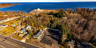 360 degree aerial panorama at Weed World Adult Arcade, Marquette, MI.
Equipment: DJI Air2s, 22 mm
Categories: Quadcopter, Michigan U.P.
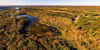 360 degree aerial panorama at William O'Brien State Parl along the St. Croix River north of Marine on St. Croix, MN. If you start canoeing at Taylors Falls too late and you don't get out at Osceola Landing, this is where you end up stranded when you miss the bus.
Equipment: DJI P4P, 24 mm
Categories: Quadcopter, St Croix River
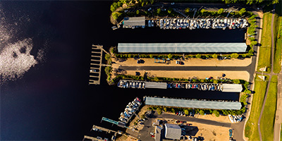 360 degree aerial panorama during sunrise at Windmill Marina on the St. Croix River in Afton, MN.
Equipment: DJI P4P, 24 mm
Categories: Quadcopter, St Croix River
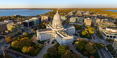 360 degree aerial panorama at the Wisconsin State Capitolin in Madison, WI.
Equipment: DJI P4P, 24 mm
Categories: State Capitols, Madison, Wisconsin, Quadcopter, Wisconsin
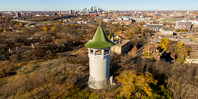 Witch’s Hat Water Tower in Tower Hill Park, Minneapolis, MN. This decommissioned water tower was the inspiration for Bob Dylan’s All Along The Watchtower. Built on the highest hill in Minneapolis, the tower is clearly visible from Bob Dylan’s former Dinkytown neighborhood.
Equipment: DJI P3A, 20 mm
Categories: Minneapolis, Quadcopter
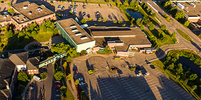 360 degree aerial panorama at Woodbury Central Park in Woodbury, MN.
Equipment: DJI P4P, 24 mm
Categories: Quadcopter
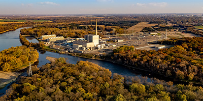 360 degree aerial panorama near the Xcel Monticello Nuclear Generating Plant along the Mississippi River in Monticello, MN
Equipment: DJI Air2s, 22 mm
Categories: Industrial, Mississippi River, Quadcopter, Saint Cloud
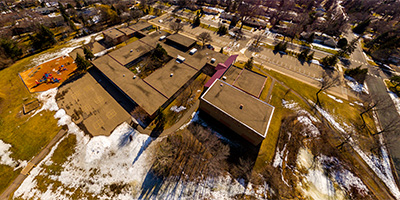 360 degree aerial panorama over Emmet D. Williams Elementary School in Shoreview, MN
Equipment: DJI P3A, 20 mm
Categories: Quadcopter, Shoreview
Start with the "Featured" category to see an assortment of my most interesting panoramas.