Welcome to BigEyeInTheSky.com
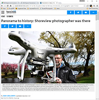
I'm Ed Fink, these are my 360 degree panoramas. I was the first photographer in the world to shoot 360 degree panoramas from a helicopter. Today I'm a FAA licensed drone pilot and shoot most of my aerials with a quadcopter.
In addition to shooting aerial panoramas, I'm also a Google Street View Trusted Photographer in Minneapolis shooting Street View tours inside local businesses.
I publish thousands of 360 degree panoramas and virtual tours to Google Maps, where I currently have over 100 MILLION VIEWS.
Ask me for more information or an estimate for your business!
Facebook - BigEyeInTheSky360
Google Maps - Ed Fink

VISITOR COMMENTS:
"That's the coolest thing on the web."
"You brought tears to my eyes."
"Mind blowing."
"One of the neatest photo sites I've ever seen."
"I'm afraid of heights and when I looked straight down I nearly threw up!"
"I am stunned by the quality and possible applications, nice job."
"That combo of eye-in-the-sky with eyes on the ground is fantastic."
"I sent this to every pilot I know."
"HOW IS THIS EVEN POSSIBLE?!"
"The 360 shots are almost unbelieveable!!!!"
"Oh my gosh Ed - they are just beautiful."
"That aerial panorama over Lake Calhoun is totally awesome"
"FANTASTIC!!!!"
"I've instantly become a fan of your panorama photos!"
"Wow, your panoramas are like nothing I have ever seen before. Very impressive!"
"the absolute best I have seen anywhere."
"ED - I am not surprised by all the comments you have received. The VR is AWESOME!"


Select a panorama category:
 360 degree aerial panorama over the Coffman Memorial Union at the University of Minnesota.
Equipment: Nikon D70s, Sigma 8mm, PocketWizard Plus
Helicopter: Davis Aviation
Pilot: Mark Boyer
Categories: Mississippi River, University of Minnesota
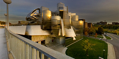 360 degree panorama of the Weisman Art Museum and Mississippi River bridge at sunset.
Equipment: Nikon D70, Sigma 8mm
Categories: Minneapolis, Mississippi River, University of Minnesota
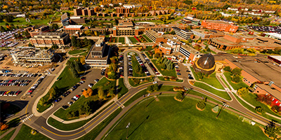
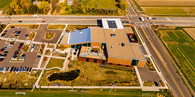 Bell Museum, Minnesota's official natural history museum and planetarium in Falcon Heights, MN.
Equipment: DJI P4P, 24 mm
Categories: Quadcopter, University of Minnesota
 360 degree panorama showing the collapsed I-35W bridge from the University of Minnesota’s bikeway bridge over the Mississippi River.
This was shot August 15th, the morning Mayor Rybak ordered the bikeway reopened, but by the afternoon Sheriff Stanek ordered the bikeway closed again.
Equipment: NikonD70, Sigma 8mm, Nodal Ninja 3, PocketWizard Plus
Categories: 35W Bridge Collapse, Bridges, Minneapolis, Mississippi River, University of Minnesota
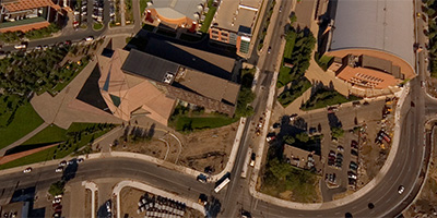
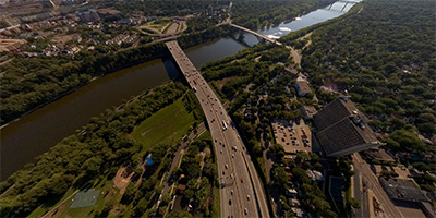 360 degree aerial panorama over I-94 at Riverside Ave., near the University of Minnesota Medical Center, Fairview Riverside Campus.
Equipment: Nikon D70s, Sigma 8mm, PocketWizard Plus
Helicopter: Davis Aviation
Pilot: Mark Boyer
Categories: University of Minnesota
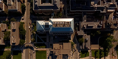
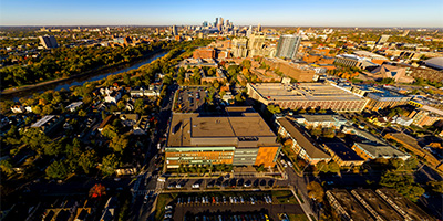
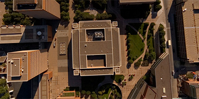
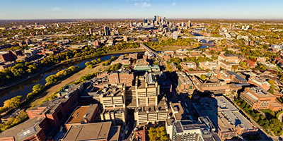 360 degree aerial panorama over the University of Minnesota at the Phillips-Wangensteen Building in Minneapolis, MN.
Equipment: DJI P4P, 24 mm
Categories: Minneapolis, Quadcopter, University of Minnesota
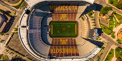 TCF Stadium at the University of Minnesota
Equipment: DJI P3A, 20 mm
Categories: Minneapolis, Quadcopter, University of Minnesota
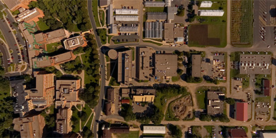
 360 degree aerial panorama of the Duluth campus of the University of Minnesota.
Equipment: DJI P3A, 20 mm
Categories: Duluth, Quadcopter, University of Minnesota
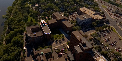
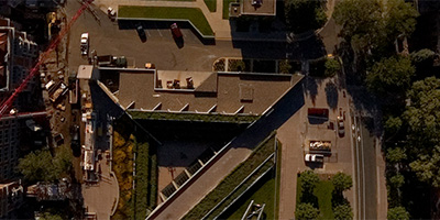
 Aerial panorama over the University of Minnesota Health Clinics and Surgery Center in Minneapolis, MN.
Equipment: DJI P3A, 20 mm
Categories: Minneapolis, Quadcopter, University of Minnesota
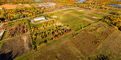 360 degree aerial panorama over University of Minnesota Horticultural Research Center Apple Orchard in Victoria, MN.
Equipment: DJI P4P, 24 mm
Categories: Apple Orchards, Quadcopter, University of Minnesota
 360 degree aerial panorama over the University of Minnesota Medical Center, Fairview Riverside Campus Corporate Building on the west bank of the Mississippi River.
Equipment: Nikon D70s, Sigma 8mm, PocketWizard Plus
Helicopter: Davis Aviation
Pilot: Mark Boyer
Categories: University of Minnesota
 360 degree aerial panorama over the Gateway area at University Ave and Oak St. at the University of Minnesota.
Equipment: Nikon D70s, Sigma 8mm, PocketWizard Plus
Helicopter: Davis Aviation
Pilot: Mark Boyer
Categories: University of Minnesota
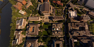 360 degree aerial panorama over the mall area at University of Minnesota.
Equipment: Nikon D70s, Sigma 8mm, PocketWizard Plus
Helicopter: Davis Aviation
Pilot: Mark Boyer
Categories: University of Minnesota
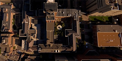 360 degree aerial panorama over the Mayo Memorial Building at the University of Minnesota.
Equipment: Nikon D70s, Sigma 8mm, PocketWizard Plus
Helicopter: Davis Aviation
Pilot: Mark Boyer
Categories: University of Minnesota
 360 degree aerial panorama over Middlebrook Hall at the University of Minnesota West Bank.
Equipment: Nikon D70s, Sigma 8mm, PocketWizard Plus
Helicopter: Davis Aviation
Pilot: Mark Boyer
Categories: University of Minnesota
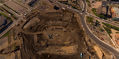 360 degree aerial panorama over the new Gopher Stadium Construction Site at the University of Minnesota.
Equipment: Nikon D70s, Sigma 8mm, PocketWizard Plus
Helicopter: Davis Aviation
Pilot: Mark Boyer
Categories: University of Minnesota
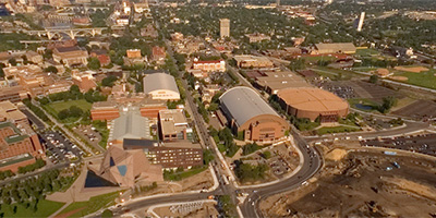 360 degree aerial panorama over Stadium Village area at the University of Minnesota.
Equipment: Nikon D70s, Sigma 8mm, PocketWizard Plus
Helicopter: Davis Aviation
Pilot: Mark Boyer
Categories: University of Minnesota
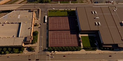 360 degree aerial panorama over the tennis courts at the intersection of 17th Ave. and 4th St. at the University of Minnesota.
Equipment: Nikon D70s, Sigma 8mm, PocketWizard Plus
Helicopter: Davis Aviation
Pilot: Mark Boyer
Categories: University of Minnesota
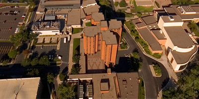
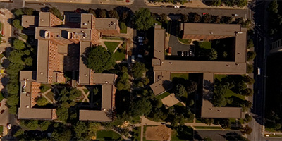 360 degree aerial panorama over Territorial Hall in the Health area at the University of Minnesota.
Equipment: Nikon D70s, Sigma 8mm, PocketWizard Plus
Helicopter: Davis Aviation
Pilot: Mark Boyer
Categories: University of Minnesota
 360 degree aerial panorama over Williamson Hall at University of Minnesota.
Equipment: Nikon D70s, Sigma 8mm, PocketWizard Plus
Helicopter: Davis Aviation
Pilot: Mark Boyer
Categories: University of Minnesota
 360 degree aerial panorama over Wilson Library, near Carlson School of Management at the University of Minnesota West Bank.
Equipment: Nikon D70s, Sigma 8mm, PocketWizard Plus
Helicopter: Davis Aviation
Pilot: Mark Boyer
Categories: University of Minnesota
 360 degree aerial panorama over the Cargill Building - Microbial and Plant Genomics on University of Minnesota’s St. Paul Campus. Also visible is the State Fairgrounds during the 2007 State Fair.
Equipment: Nikon D70s, Sigma 8mm, PocketWizard Plus
Helicopter: Davis Aviation
Pilot: Mark Boyer
Categories: Saint Paul, University of Minnesota
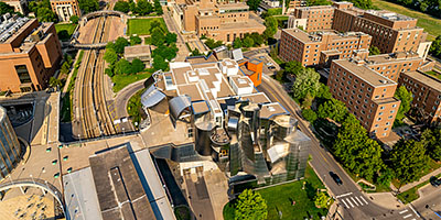 360 degree aerial panorama at Weisman Art Museum on the University of Minnesota Campus along the Mississippi River in Minneapolis, MN. This was planned for World Wide Panorama: Museums but I submitted a Mill City Museum aerial instead.
Equipment: DJI Air2s, 22 mm
Categories: Minneapolis, Mississippi River, University of Minnesota

Start with the "Featured" category to see an assortment of my most interesting panoramas.