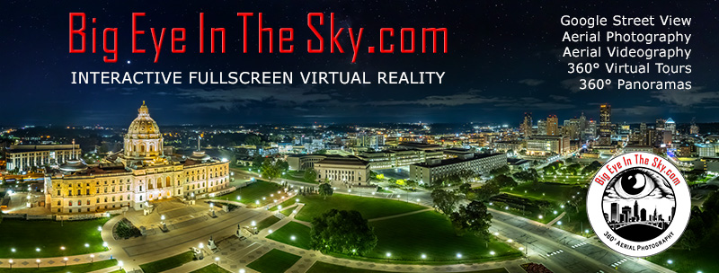
Welcome to BigEyeInTheSky.com
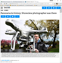
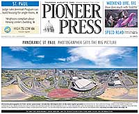
I'm Ed Fink, these are my 360 degree panoramas. I was the first photographer in the world to shoot 360 degree panoramas from a helicopter. Today I'm a FAA licensed drone pilot and shoot most of my aerials with a quadcopter.
In addition to shooting aerial panoramas, I'm also a Google Street View Trusted Photographer in Minneapolis shooting Street View tours inside local businesses.
I publish thousands of 360 degree panoramas and virtual tours to Google Maps, where I currently have over 100 MILLION VIEWS.
Ask me for more information or an estimate for your business!
Facebook - BigEyeInTheSky360
Google Maps - Ed Fink

VISITOR COMMENTS:
"That's the coolest thing on the web."
"You brought tears to my eyes."
"Mind blowing."
"One of the neatest photo sites I've ever seen."
"I'm afraid of heights and when I looked straight down I nearly threw up!"
"I am stunned by the quality and possible applications, nice job."
"That combo of eye-in-the-sky with eyes on the ground is fantastic."
"I sent this to every pilot I know."
"HOW IS THIS EVEN POSSIBLE?!"
"The 360 shots are almost unbelieveable!!!!"
"Oh my gosh Ed - they are just beautiful."
"That aerial panorama over Lake Calhoun is totally awesome"
"FANTASTIC!!!!"
"I've instantly become a fan of your panorama photos!"
"Wow, your panoramas are like nothing I have ever seen before. Very impressive!"
"the absolute best I have seen anywhere."
"ED - I am not surprised by all the comments you have received. The VR is AWESOME!"

Select a panorama category:
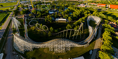 Sunset Over Adventureland Park in Des Moines, IA.
Equipment: DJI P3A, 20 mm
Categories: Iowa, Quadcopter
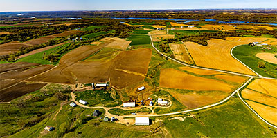 360 degree aerial panorama at the Balltown Iowa Scenic Overlook, with Mississippi River in the distance to the north.
Equipment: DJI Air2s, 22 mm
Categories: Iowa, Mississippi River, Quadcopter
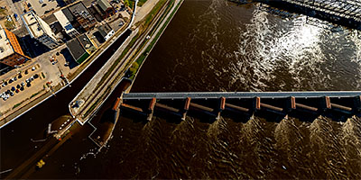
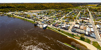 360 degree aerial panorama at Mississippi River Lock and Dam #12 in Bellevue, IA.
Equipment: DJI Air2s, 22 mm
Categories: Iowa, Mississippi River, Quadcopter
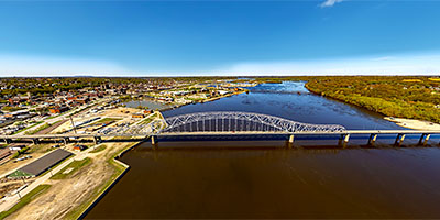
 360 degree aerial panorama over the Mississippi River at Bettendorf, IA.
Equipment: DJI Air2s, 22 mm
Categories: Iowa, Mississippi River, Quadcopter
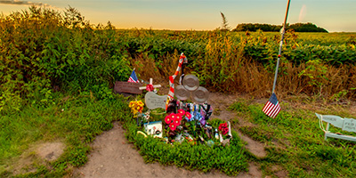 On "The Day The Music Died", February 3rd, 1959, this is where it died. Memorial at the plane crash site north of Clear Lake, Iowa, that killed musicians Buddy Holly, J.P. (The Big Bopper) Richardson, Ritchie Valens, and pilot Roger Peterson.
Equipment: Nikon D300s, Sigma 8mm, Nodal Ninja Ultimate R1
Categories: Buddy Holly Crash Site, Iowa, Music
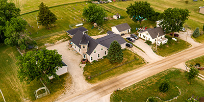 360 degree aerial panorama at a church in Carlisle, IA
Equipment: DJI P4P, 24 mm
Categories: Iowa, Quadcopter
 Sunrise Over Cowles Commons in Downtown Des Moines, IA.
Equipment: DJI P3A, 20 mm
Categories: Iowa, Quadcopter
 360 degree aerial panorama over the Davenport, IA Mississippi River floodgates.
Equipment: DJI Air2s, 22 mm
Categories: Iowa, Mississippi River, Quadcopter
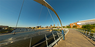
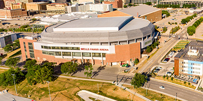 360 degree aerial panorama over the Des Moines River near the Wells Fargo Arena in downtown Des Moines, IA.
Equipment: DJI P4P, 24 mm
Categories: Iowa, Quadcopter
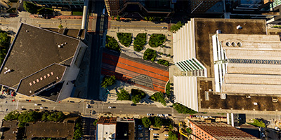
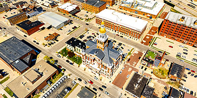 360 degree aerial panorama at the Dubuque County Courthouse in Dubuque, IA.
Equipment: DJI Air2s, 22 mm
Categories: Iowa, Mississippi River, Quadcopter
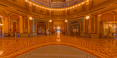 360 degree panorama inside the Iowa State Capitoldirectly under the dome.
Equipment: Ricoh Theta Z1, FE
Categories: State Capitols, Iowa
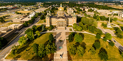
 360 degree aerial panorama east of the Iowa State Capitol in Des Moines, IA.
Equipment: DJI P4P, 24 mm
Categories: State Capitols, Iowa, Quadcopter
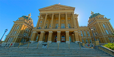 360 degree panorama of the Iowa State Capitol exterior on the west steps.
Equipment: Ricoh Theta Z1, FE
Categories: State Capitols, Iowa
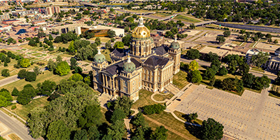
 360 degree aerial panorama at sunset over the historic Iowa State Capitol in Des Moines, IA. Building construction completed in 1886 but the conversion of gas lights to electric in 1904 caused a fire requiring major restoration. In the 1980s the Capitol exterior had deteriorated, with sandstone chunks falling from the building, requiring a nine phase restoration project that completed in 1998.
This is my submission to the World Wide Panorama event History (revisited).
https://worldwidepanorama.org/wwp621/
360 degree aerial panorama at sunset over the historic Iowa State Capitol in Des Moines, IA. Building construction completed in 1886 but the conversion of gas lights to electric in 1904 caused a fire requiring major restoration. In the 1980s the Capitol exterior had deteriorated, with sandstone chunks falling from the building, requiring a nine phase restoration project that completed in 1998.
This is my submission to the World Wide Panorama event History (revisited).
https://worldwidepanorama.org/wwp621/
Equipment: DJI P4P, 24 mm
Categories: State Capitols, Iowa, Quadcopter, World Wide Panorama
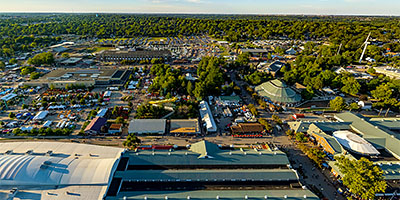
 360 degree aerial panorama at the Iowa State Fair near the Giant Slide.
Equipment: DJI Air2s, 22 mm
Categories: Iowa
 360 degree aerial panorama of the Iowa State Fair from over the Sheep Barn. Prettier than it sounds!
Equipment: DJI Air2s, 22 mm
Categories: Iowa, Quadcopter
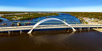
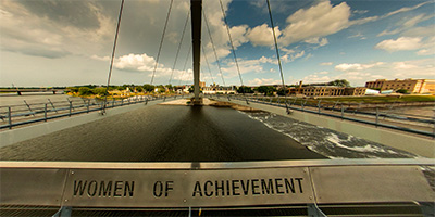
 360 degree aerial panorama at the Julien Dubuque Bridge over the Mississippi River in Dubuque, IA.
Equipment: DJI Air2s, 22 mm
Categories: Iowa, Mississippi River, Quadcopter
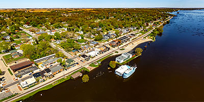 360 degree aerial panorama upriver from the Quad Cities at Le Claire, IA, over a flooded Mississippi River.
Equipment: DJI Air2s, 22 mm
Categories: Iowa, Mississippi River, Quadcopter
 360 degree aerial panorama over flooded Mississippi River near LeClaire Park and Bandshell in downtown Davenport, IA.
Equipment: DJI Air2s, 22 mm
Categories: Iowa, Mississippi River, Quadcopter
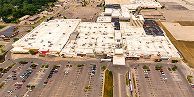 360 degree aerial panorama above Merle Hay Mall in Des Moines, IA.
Equipment: DJI P4P, 24 mm
Categories: Iowa, Quadcopter
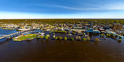
 360 degree aerial panorama over flooded Mississippi River near Modern Woodmen Park in Davenport, IA.
Equipment: DJI Air2s, 22 mm
Categories: Featured, Iowa, Mississippi River, Quadcopter
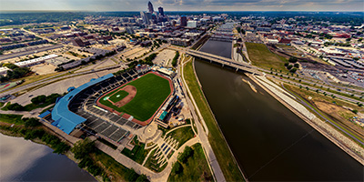 360 degree aerial panorama at Principal Park Baseball Stadium. Near the confluence of the Raccoon River and Des Moines River in Des Moines, IA.
Equipment: DJI P4P, 24 mm
Categories: Iowa, Quadcopter
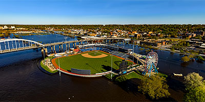
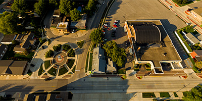 Above Surf Ballroom and Three Stars Plaza in Clear Lake, Iowa
Equipment: DJI P3A, 20 mm
Categories: Buddy Holly Crash Site, Iowa, Music, Quadcopter
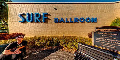 In front of the historic Surf Ballroom in Clear Lake, Iowa, site of the last performance of Buddy Holly, J.P. (The Big Bopper) Richardson, and Ritchie Valens. The crash site is in about 5 miles north of here.
Equipment: Nikon D300s, Sigma 8mm, Nodal Ninja Ultimate R1
Categories: Buddy Holly Crash Site, Iowa, Music
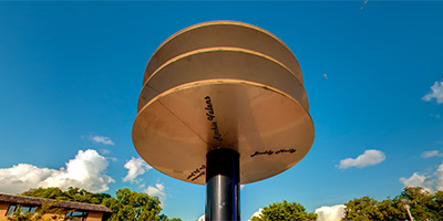 At Three Stars Plaza near the historic Surf Ballroom in Clear Lake, Iowa. The 15’ sculpture at the plaza honors the last performance of Buddy Holly, J.P. (The Big Bopper) Richardson, and Ritchie Valens before their plane crash later that night about 5 miles north of here.
Equipment: Nikon D300s, Sigma 8mm, Nodal Ninja Ultimate R1
Categories: Buddy Holly Crash Site, Iowa, Music
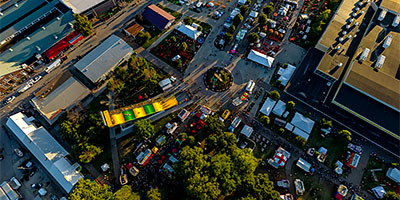
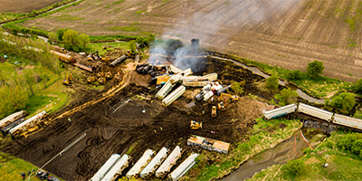 360 degree aerial panorama above Otter Creek in Sibley, Iowa after a train derailment.
Equipment: DJI P4P, 24 mm
Categories: Industrial, Iowa, Quadcopter, Railroads
Start with the "Featured" category to see an assortment of my most interesting panoramas.