Welcome to BigEyeInTheSky.com
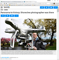
I'm Ed Fink, these are my 360 degree panoramas. I was the first photographer in the world to shoot 360 degree panoramas from a helicopter. Today I'm a FAA licensed drone pilot and shoot most of my aerials with a quadcopter.
In addition to shooting aerial panoramas, I'm also a Google Street View Trusted Photographer in Minneapolis shooting Street View tours inside local businesses.
I publish thousands of 360 degree panoramas and virtual tours to Google Maps, where I currently have over 100 MILLION VIEWS.
Ask me for more information or an estimate for your business!
Facebook - BigEyeInTheSky360
Google Maps - Ed Fink


VISITOR COMMENTS:
"That's the coolest thing on the web."
"You brought tears to my eyes."
"Mind blowing."
"One of the neatest photo sites I've ever seen."
"I'm afraid of heights and when I looked straight down I nearly threw up!"
"I am stunned by the quality and possible applications, nice job."
"That combo of eye-in-the-sky with eyes on the ground is fantastic."
"I sent this to every pilot I know."
"HOW IS THIS EVEN POSSIBLE?!"
"The 360 shots are almost unbelieveable!!!!"
"Oh my gosh Ed - they are just beautiful."
"That aerial panorama over Lake Calhoun is totally awesome"
"FANTASTIC!!!!"
"I've instantly become a fan of your panorama photos!"
"Wow, your panoramas are like nothing I have ever seen before. Very impressive!"
"the absolute best I have seen anywhere."
"ED - I am not surprised by all the comments you have received. The VR is AWESOME!"


Select a panorama category:
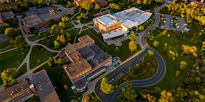
 360 degree aerial panorama across from the American Family Children's Hospital at the University of Wisconsin in Madison, WI.
Equipment: DJI P4P, 24 mm
Categories: Madison, Wisconsin, Quadcopter, University of Wisconsin, Wisconsin
 360 degree aerial panorama above the University of Wisconsin's Sterling Hall in Madison, WI.
Equipment: DJI P4P, 24 mm
Categories: Madison, Wisconsin, Quadcopter, University of Wisconsin, Wisconsin
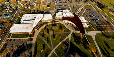
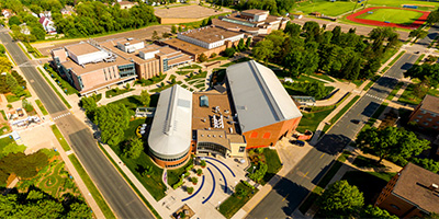 Aerial panorama of the Memorial Student Center on the U of W - Stout campus in Menomine, WI.
Equipment: DJI P3A, 20 mm
Categories: Quadcopter, University of Wisconsin, Wisconsin
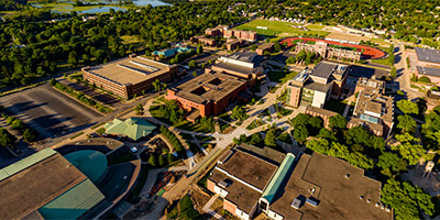
 360 degree aerial panorama over the University of Wisconsin - Eau Claire.
Equipment: DJI P4P, 24 mm
Categories: Eau Claire OLD, Quadcopter, University of Wisconsin, Wisconsin
 360 degree aerial panorama above the University of Wisconsin - La Crosse Campus, in La Crosse, WI.
Equipment: DJI P4P, 24 mm
Categories: La Crosse, Mississippi River, Quadcopter, University of Wisconsin, Wisconsin
 360 degree aerial panorama over University of Wisconsin - Superior.
Equipment: DJI Air2s, 22 mm
Categories: Duluth, Quadcopter, University of Wisconsin, Wisconsin
 360 degree aerial panorama over the University of Wisconsin at River Falls.
Equipment: DJI P4P, 24 mm
Categories: Quadcopter, University of Wisconsin, Wisconsin
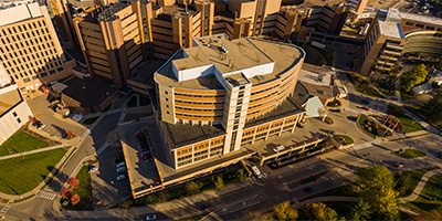
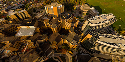 360 degree aerial panorama at the University of Wisconsin Health University Hospital in Madison, WI.
Equipment: DJI P4P, 24 mm
Categories: Madison, Wisconsin, Quadcopter, University of Wisconsin, Wisconsin
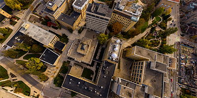
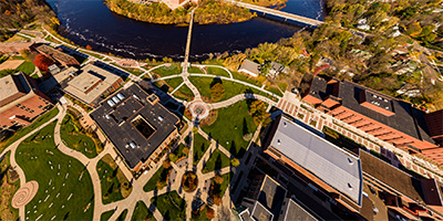
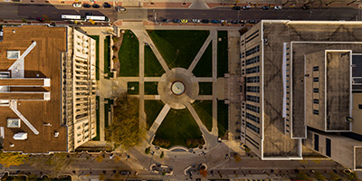 360 degree aerial panorama at the University of Wisconsin Library Mall in Madison, WI.
Equipment: DJI P4P, 24 mm
Categories: Madison, Wisconsin, Quadcopter, University of Wisconsin, Wisconsin
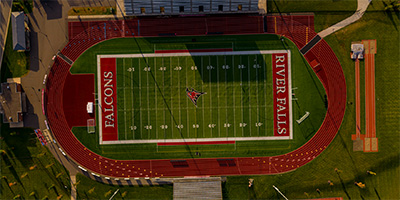 360 degree aerial panorama over the University of Wisconsin River Falls Falcon Stadium.
Equipment: DJI P4P, 24 mm
Categories: Quadcopter, University of Wisconsin, Wisconsin

Start with the "Featured" category to see an assortment of my most interesting panoramas.