Welcome to BigEyeInTheSky.com
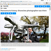
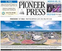
I'm Ed Fink, these are my 360 degree panoramas. I was the first photographer in the world to shoot 360 degree panoramas from a helicopter. Today I'm a FAA licensed drone pilot and shoot most of my aerials with a quadcopter.
In addition to shooting aerial panoramas, I'm also a Google Street View Trusted Photographer in Minneapolis shooting Street View tours inside local businesses.
I publish thousands of 360 degree panoramas and virtual tours to Google Maps, where I currently have over 100 MILLION VIEWS.
Ask me for more information or an estimate for your business!
Facebook - BigEyeInTheSky360
Google Maps - Ed Fink

VISITOR COMMENTS:
"That's the coolest thing on the web."
"You brought tears to my eyes."
"Mind blowing."
"One of the neatest photo sites I've ever seen."
"I'm afraid of heights and when I looked straight down I nearly threw up!"
"I am stunned by the quality and possible applications, nice job."
"That combo of eye-in-the-sky with eyes on the ground is fantastic."
"I sent this to every pilot I know."
"HOW IS THIS EVEN POSSIBLE?!"
"The 360 shots are almost unbelieveable!!!!"
"Oh my gosh Ed - they are just beautiful."
"That aerial panorama over Lake Calhoun is totally awesome"
"FANTASTIC!!!!"
"I've instantly become a fan of your panorama photos!"
"Wow, your panoramas are like nothing I have ever seen before. Very impressive!"
"the absolute best I have seen anywhere."
"ED - I am not surprised by all the comments you have received. The VR is AWESOME!"

Select a panorama category:
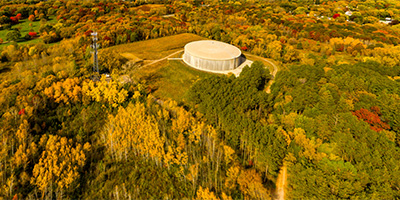
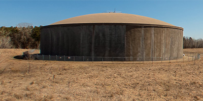
 360 degree aerial panorama above Abbott near I-35E and Hwy. 36 in Little Canada, MN.
Equipment: DJI Air2s, 22 mm
Categories: Industrial, Quadcopter, Roseville
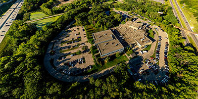
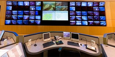
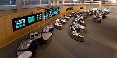 360 degree panorama shot from a lift inside the Minnesota Department of Transportation’s Regional Transportation Management Center (RTMC). MN State Patrol Dispatch, Maintenance Dispatch, and Traffic Operations work together in a state of the art Operations Center using cutting-edge technology, progressive programs, and real time information delivery systems to provide motorists with a faster, safer trip on Twin Cities area freeways.
This was an alternate shot for the 2006 Fall Equinox World Wide Panorama on Transportation.
Equipment: Nikon D70s, Sigma 8mm, Kaidan QuickPan III
Categories: Roseville, World Wide Panorama
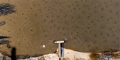
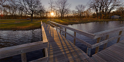
 360 degree panorama of the fishing pier in Roseville, MN’s Central Park. During the two weeks of summer when Minnesotans can’t walk on water, they are forced to fish from piers.
First panorama done with my first DSLR - a Nikon D70 with Sigma 8mm lens.
Equipment: Nikon D70, Sigma 8mm
Categories: Roseville
 360 degree aerial panorama of HarMar Mall in Roseville, MN.
Equipment: DJI P3A, 20 mm
Categories: Quadcopter, Roseville
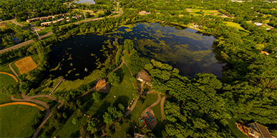
 360 degree aerial panorama over Harriet Alexandar Nature Center in Roseville, Minnesota.
Equipment: DJI P3A, 20 mm
Categories: Quadcopter, Roseville
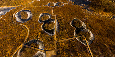
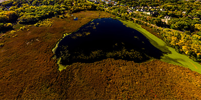
 360 degree aerial panorama above an invasion of giant Ice Spiders on Lake Josephine in Roseville, Minnesota. These monsters must have hitched a ride on a meteor that crashed into the lake - they’re obviously not from earth.
This is actually a phenomenon caused by the weight of the snow forcing water to drain upward through the ice sheet. The dendrite formation is often called an ice spider, ice octopus, or ice star.
This was my second aerial panorama from my quadcopter.
Equipment: DJI P3A, 20 mm
Categories: Quadcopter, Roseville
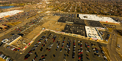
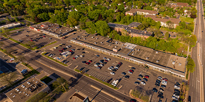 360 degree aerial panorama of Lexington Plaza Shoppes in Roseville, MN.
Equipment: DJI P4P, 24 mm
Categories: Quadcopter, Roseville
 360 degree panorama inside Minnesota Department of Transportation’s Regional Transportation Management Center (RTMC). MN State Patrol Dispatch, Maintenance Dispatch, and Traffic Operations work together in a state of the art Operations Center using cutting-edge technology, progressive programs, and real time information delivery systems to provide motorists with a faster, safer trip on Twin Cities area freeways.
This was my submission for the 2006 Fall Equinox World Wide Panorama on Transportation.
Equipment: Nikon D70s, Sigma 8mm, Kaidan QuickPan III
Categories: Roseville, World Wide Panorama
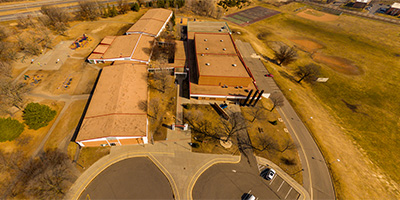 360 degree aerial panorama above Parkview Center School in Roseville, MN.
Equipment: DJI P3A, 20 mm
Categories: Quadcopter, Roseville
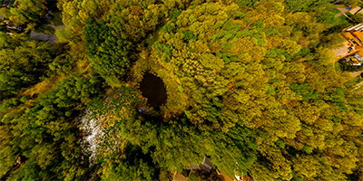
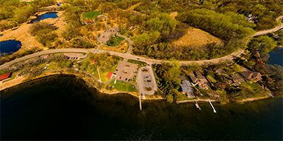
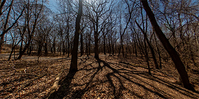
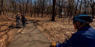
 Aerial panorama above Reservoir Woods Park.
Equipment: DJI P3A, 20 mm
Categories: Quadcopter, Roseville, Saint Paul
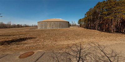
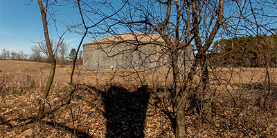
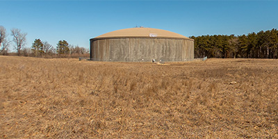
 360 degree aerial panorama above Roselawn Cemetery near Reservoir Woods in Roseville, MN.
Equipment: DJI Air2s, 22 mm
Categories: Quadcopter, Roseville
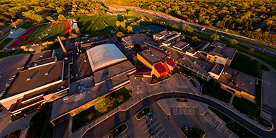 360 degree aerial panorama over Roseville Area High School (RAHS) in Roseville, MN.
Equipment: DJI P3A, 20 mm
Categories: Quadcopter, Roseville
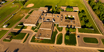 360 degree aerial panorama over Roseville Area Middle School (RAMS) in Roseville, MN.
Equipment: DJI P3A, 20 mm
Categories: Quadcopter, Roseville
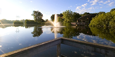
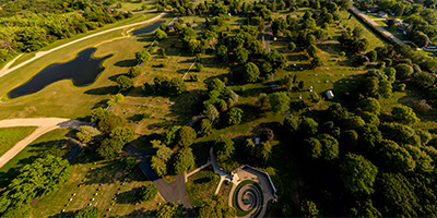
 Aerial panorama over Roseville Central Park.
Equipment: DJI P3A, 20 mm
Categories: Quadcopter, Roseville
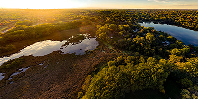 360 degree aerial panorama at sunset over Tamarack Park, just south of McCarrons Lake in Roseville, MN.
Equipment: DJI P4P, 24 mm
Categories: Quadcopter, Roseville
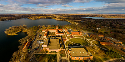 360 degree aerial panorama of University of Northwestern - St. Paul in Roseville, MN.
Equipment: DJI P3A, 20 mm
Categories: Quadcopter, Roseville
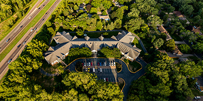 360 degree aerial panorama of Victoria Place Apartments in Roseville, MN.
Equipment: DJI P4P, 24 mm
Categories: Quadcopter, Roseville
Start with the "Featured" category to see an assortment of my most interesting panoramas.