Welcome to BigEyeInTheSky.com
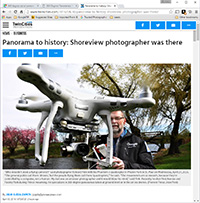
I'm Ed Fink, these are my 360 degree panoramas. I was the first photographer in the world to shoot 360 degree panoramas from a helicopter. Today I'm a FAA licensed drone pilot and shoot most of my aerials with a quadcopter.
In addition to shooting aerial panoramas, I'm also a Google Street View Trusted Photographer in Minneapolis shooting Street View tours inside local businesses.
I publish thousands of 360 degree panoramas and virtual tours to Google Maps, where I currently have over 100 MILLION VIEWS.
Ask me for more information or an estimate for your business!
Facebook - BigEyeInTheSky360
Google Maps - Ed Fink


VISITOR COMMENTS:
"That's the coolest thing on the web."
"You brought tears to my eyes."
"Mind blowing."
"One of the neatest photo sites I've ever seen."
"I'm afraid of heights and when I looked straight down I nearly threw up!"
"I am stunned by the quality and possible applications, nice job."
"That combo of eye-in-the-sky with eyes on the ground is fantastic."
"I sent this to every pilot I know."
"HOW IS THIS EVEN POSSIBLE?!"
"The 360 shots are almost unbelieveable!!!!"
"Oh my gosh Ed - they are just beautiful."
"That aerial panorama over Lake Calhoun is totally awesome"
"FANTASTIC!!!!"
"I've instantly become a fan of your panorama photos!"
"Wow, your panoramas are like nothing I have ever seen before. Very impressive!"
"the absolute best I have seen anywhere."
"ED - I am not surprised by all the comments you have received. The VR is AWESOME!"


Select a panorama category:
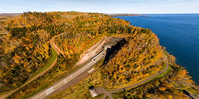 360 degree panorama above the Silver Creek Cliff Tunnel north of Duluth, MN.
Equipment: DJI P3A, 20 mm
Categories: Duluth
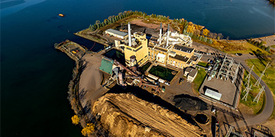 360 degree aerial panorama at Xcel Bay Front BIOMASS Power Plant on the shore of Chequamegon Bay in Ashland, WI.
Equipment: DJI Air2s, 22 mm
Categories: Duluth, Industrial, Quadcopter, Wisconsin
 360 degree aerial panorama overlooking Lake Superior from above Bardon Peak Overlook on Spirit Mountain, along Skyline Parkway in Duluth, MN.
Equipment: DJI P4P, 24 mm
Categories: Duluth, Quadcopter
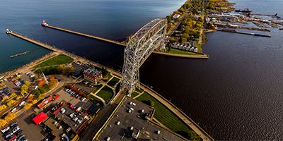 360 degree aerial panorama of Duluth Harbor and Aerial Lift Bridge.
Equipment: DJI P3A, 20 mm
Categories: Bridges, Duluth, Featured, Quadcopter
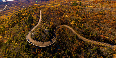
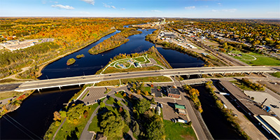 360 degree aerial panorama over Dunlap Island Park on the St. Louis River in Cloquet, MN.
Equipment: DJI Air2s, 22 mm
Categories: Duluth, Iron Range, Quadcopter
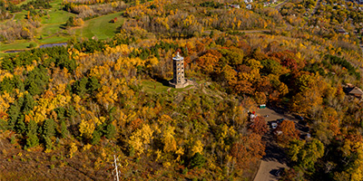 360 degree aerial panorama overlooking Lake Superior near Enger Tower in Duluth, MN.
Equipment: DJI P4P, 24 mm
Categories: Duluth, Quadcopter
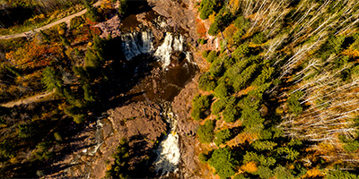 360 degree aerial panorama above Gooseberry Falls north of Duluth, MN.
Equipment: DJI P3A, 20 mm
Categories: Duluth, Quadcopter
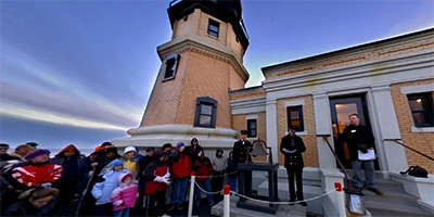 360 degree panorama of the Annual Beacon Lighting Ceremony at Split Rock Lighthouse on Lake Superior during the memorial service for the crew of the Edmund Fitzgerald.
Equipment: NikonD70, Sigma 8mm, Kaidan QuickPan III
Categories: Duluth
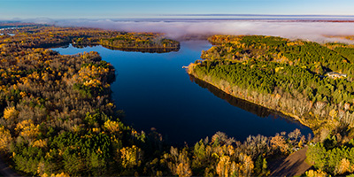 360 degree aerial panorama above Minnesota's Moose Lake State Park.
Equipment: DJI P4P, 24 mm
Categories: Duluth, Outstate Minnesota, Quadcopter
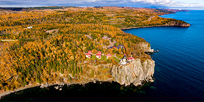 360 degree aerial panorama above Lake Superior near Minnesota's Split Rock Lighthouse State Park.
Equipment: DJI P4P, 24 mm
Categories: Duluth, Outstate Minnesota, Quadcopter
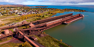 360 degree aerial panorama of the Iron Ore docks on Lake Superior's Agate Bay in Two Harbors, MN. The steel docks were originally built to load high grade iron ore from the Mesabi Iron Range onto large ships, but after World War II most of the high grade iron ore in the U.S. ran out and the industry moved to a lower grade ore, taconite, which you see here. The docks are over 1,300 feet long and seven stories tall. Today 12 million tons of taconite a year are shipped from Two Harbors to other locations on the Great Lakes eventually to be heated up to over 1000 degrees in blast furnaces, and converted into steel.
Equipment: DJI P4P, 24 mm
Categories: Duluth, Industrial, Outstate Minnesota, Quadcopter, World Wide Panorama
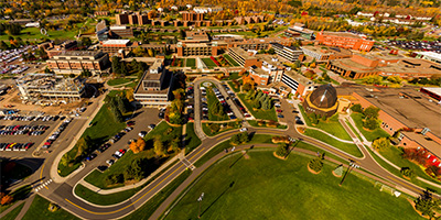 360 degree aerial panorama of the Duluth campus of the University of Minnesota.
Equipment: DJI P3A, 20 mm
Categories: Duluth, Quadcopter, University of Minnesota
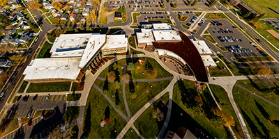 360 degree aerial panorama over University of Wisconsin - Superior.
Equipment: DJI Air2s, 22 mm
Categories: Duluth, Quadcopter, University of Wisconsin, Wisconsin
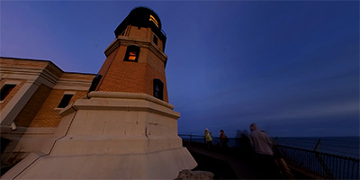 360 degree panorama at sunset at Split Rock Lighthouse on Lake Superior after the Annual Beacon Lighting Ceremony and memorial service for the crew of the Edmund Fitzgerald.
Equipment: NikonD70, Sigma 8mm, Kaidan QuickPan III
Categories: Duluth, Featured, Outstate Minnesota

Start with the "Featured" category to see an assortment of my most interesting panoramas.