Welcome to BigEyeInTheSky.com
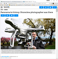
I'm Ed Fink, these are my 360 degree panoramas. I was the first photographer in the world to shoot 360 degree panoramas from a helicopter. Today I'm a FAA licensed drone pilot and shoot most of my aerials with a quadcopter.
In addition to shooting aerial panoramas, I'm also a Google Street View Trusted Photographer in Minneapolis shooting Street View tours inside local businesses.
I publish thousands of 360 degree panoramas and virtual tours to Google Maps, where I currently have over 100 MILLION VIEWS.
Ask me for more information or an estimate for your business!
Facebook - BigEyeInTheSky360
Google Maps - Ed Fink


VISITOR COMMENTS:
"That's the coolest thing on the web."
"You brought tears to my eyes."
"Mind blowing."
"One of the neatest photo sites I've ever seen."
"I'm afraid of heights and when I looked straight down I nearly threw up!"
"I am stunned by the quality and possible applications, nice job."
"That combo of eye-in-the-sky with eyes on the ground is fantastic."
"I sent this to every pilot I know."
"HOW IS THIS EVEN POSSIBLE?!"
"The 360 shots are almost unbelieveable!!!!"
"Oh my gosh Ed - they are just beautiful."
"That aerial panorama over Lake Calhoun is totally awesome"
"FANTASTIC!!!!"
"I've instantly become a fan of your panorama photos!"
"Wow, your panoramas are like nothing I have ever seen before. Very impressive!"
"the absolute best I have seen anywhere."
"ED - I am not surprised by all the comments you have received. The VR is AWESOME!"


Select a panorama category:
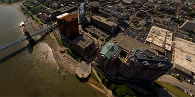
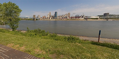
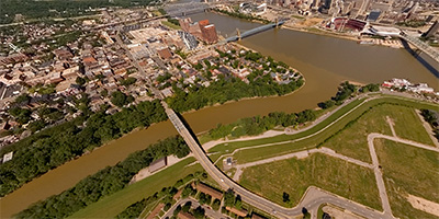
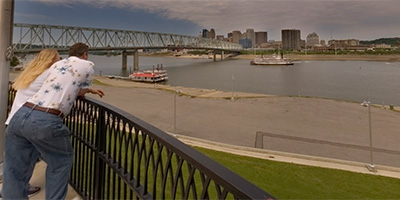
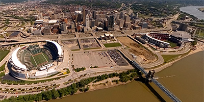
 360 degree aerial panorama of Cincinnati from over the Ohio River at Newport, Kentucky, just east of the John Roebling Suspension Bridge.
This is the entry point to a 140 panorama interactive aerial virtual tour of Columbus, Dayton, Cincinnati, and Northern Kentucky.
Equipment: Nikon D70s, Sigma 8mm, PocketWizard Plus
Helicopter: D&M Aviation Inc. 513-602-3177
Pilot: Dan Kelly
Categories: Cincinnati, Ohio, Featured
 Over north end of the James Roebling Suspension Bridge in Cincinnati, Ohio.
Equipment: Nikon D70s, Sigma 8mm, PocketWizard Plus
Helicopter: Signature Engines, Inc.
Pilot: Bill Schmidt
Categories: Cincinnati, Ohio
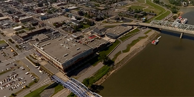 360 degree aerial panorama over the Ohio River near Newport, Kentucky, near the Newport Southbank Bridge (AKA The Purple People Bridge), just east of the Newport on the Levee entertainment complex across the river from Cincinnati, Ohio.
Equipment: Nikon D70s, Sigma 8mm, PocketWizard Plus
Helicopter: D&M Aviation Inc. 513-602-3177
Pilot: Dan Kelly
Categories: Cincinnati, Ohio
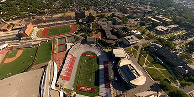
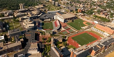
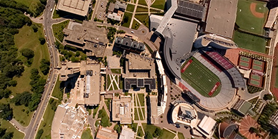 University of Cincinnati, north of the stadium.
Equipment: Nikon D70s, Sigma 8mm, PocketWizard Plus
Helicopter: Signature Engines, Inc.
Pilot: Bill Schmidt
Categories: Cincinnati, Ohio
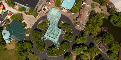 360 degree aerial panorama over the 1/3 scale Eiffel Tower at Kings Island amusement park in Mason, Ohio, 24 miles northeast of Cincinnati and 35 miles south of Dayton, Ohio.
Equipment: Nikon D70s, Sigma 8mm, PocketWizard Plus
Helicopter: D&M Aviation Inc. 513-602-3177
Pilot: Dan Kelly
Categories: Cincinnati, Ohio
 Above the Northern Kentucky University campus.
Equipment: Nikon D70s, Sigma 8mm, PocketWizard Plus
Helicopter: Signature Engines, Inc.
Pilot: Bill Schmidt
Categories: Cincinnati, Ohio
 Mt. Adams, NE of downtown Cincinnati, Ohio.
Equipment: Nikon D70s, Sigma 8mm, PocketWizard Plus
Helicopter: Signature Engines, Inc.
Pilot: Bill Schmidt
Categories: Cincinnati, Ohio
 360 degree aerial panorama of downtown Cincinnati, Ohio, just south of the Hyatt and the Millennium Hotel and southeast of the Duke Energy Center, and north of the Cincinnati Enquirer building.
Equipment: Nikon D70s, Sigma 8mm, PocketWizard Plus
Helicopter: D&M Aviation Inc. 513-602-3177
Pilot: Dan Kelly
Categories: Cincinnati, Ohio
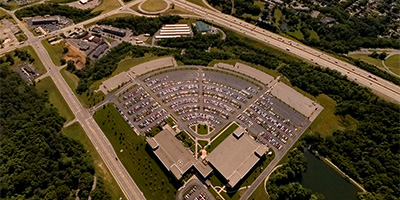
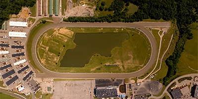 Turfway Park Area in Florence
Equipment: Nikon D70s, Sigma 8mm, PocketWizard Plus
Helicopter: Signature Engines, Inc.
Pilot: Bill Schmidt
Categories: Cincinnati, Ohio
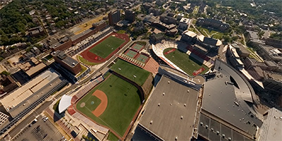
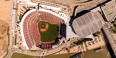 Above the Great American Ball Park in downtown, Cincinnati, Ohio
Equipment: Nikon D70s, Sigma 8mm, PocketWizard Plus
Helicopter: Signature Engines, Inc.
Pilot: Bill Schmidt
Categories: Cincinnati, Ohio
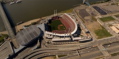
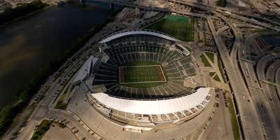 360 degree aerial panorama above the Paul Brown stadium, home of the Cincinnati Bengals.
Equipment: Nikon D70s, Sigma 8mm, PocketWizard Plus
Helicopter: D&M Aviation Inc. 513-602-3177
Pilot: Dan Kelly
Categories: Cincinnati, Ohio
 Lunkin Airport east of Cincinnati from about 2,000’.
Equipment: Nikon D70s, Sigma 8mm, PocketWizard Plus
Helicopter: Signature Engines, Inc.
Pilot: Bill Schmidt
Categories: Cincinnati, Ohio
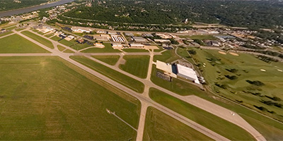
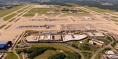
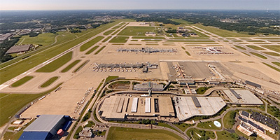 CVG Airport
Equipment: Nikon D70s, Sigma 8mm, PocketWizard Plus
Helicopter: Signature Engines, Inc.
Pilot: Bill Schmidt
Categories: Cincinnati, Ohio
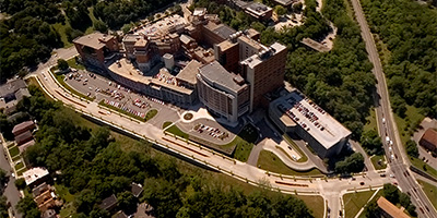
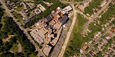
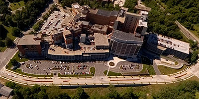
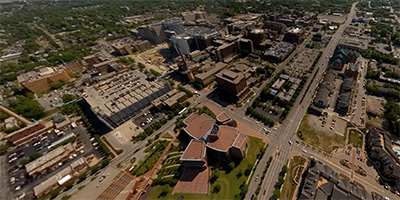
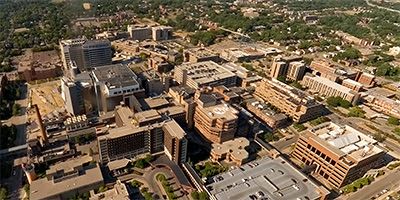
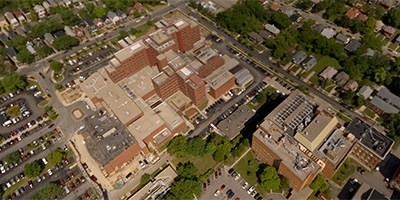
 University Hospital
Equipment: Nikon D70s, Sigma 8mm, PocketWizard Plus
Helicopter: Signature Engines, Inc.
Pilot: Bill Schmidt
Categories: Cincinnati, Ohio
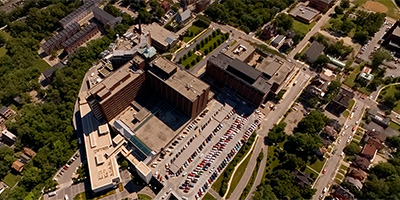
 Good Samaritan Hospital
Equipment: Nikon D70s, Sigma 8mm, PocketWizard Plus
Helicopter: Signature Engines, Inc.
Pilot: Bill Schmidt
Categories: Cincinnati, Ohio
 Christ Hospital in Cincinnati, Ohio
Equipment: Nikon D70s, Sigma 8mm, PocketWizard Plus
Helicopter: Signature Engines, Inc.
Pilot: Bill Schmidt
Categories: Cincinnati, Ohio
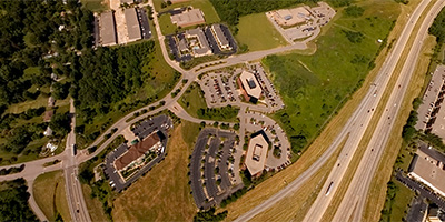 METS Center
Equipment: Nikon D70s, Sigma 8mm, PocketWizard Plus
Helicopter: Signature Engines, Inc.
Pilot: Bill Schmidt
Categories: Cincinnati, Ohio
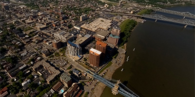
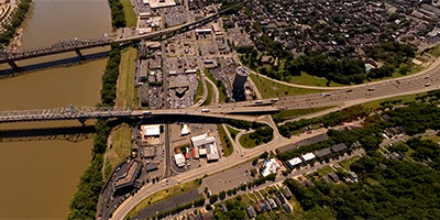
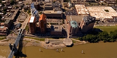
 360 degree aerial panorama over Ohio River north of the Northern Kentucky Convention Center and west of the John Roebling Suspension Bridge, across the river from the Paul Brown Stadium in Cincinnati, Ohio.
Equipment: Nikon D70s, Sigma 8mm, PocketWizard Plus
Helicopter: D&M Aviation Inc. 513-602-3177
Pilot: Dan Kelly
Categories: Cincinnati, Ohio
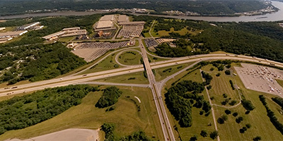
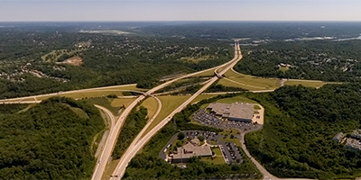
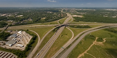 360 degree aerial panorama near the junction of I-71/I-75 and I-275 in Northern Kentucky, east of the Cincinnati / Northern Kentucky International Airport (CVG) in Boone County, Kentucky.
Equipment: Nikon D70s, Sigma 8mm, PocketWizard Plus
Helicopter: D&M Aviation Inc. 513-602-3177
Pilot: Dan Kelly
Categories: Cincinnati, Ohio
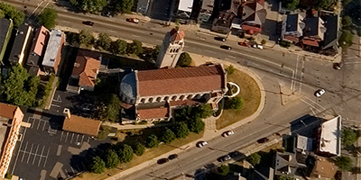
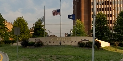
 Above a church in Covington, Kentucky.
Equipment: Nikon D70s, Sigma 8mm, PocketWizard Plus
Helicopter: Signature Engines, Inc.
Pilot: Bill Schmidt
Categories: Cincinnati, Ohio
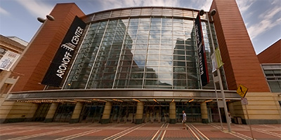 360 degree panorama on Walnut St. in front of the Aronoff Center in downtown Cincinnati, Ohio.
Equipment: Nikon D70s, Sigma 8mm, Kaidan QuickPan III, PocketWizard Plus
Categories: Cincinnati, Ohio
 Barn and orange roof bldg. on N. shore of Ohio River, E. of Lunken
Equipment: Nikon D70s, Sigma 8mm, PocketWizard Plus
Helicopter: Signature Engines, Inc.
Pilot: Bill Schmidt
Categories: Cincinnati, Ohio
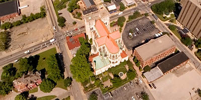
 360 degree panorama in front of the Church of Saint Francis Xavier in downtown Cincinnati, Ohio.
Equipment: Nikon D70s, Sigma 8mm, Kaidan QuickPan III, PocketWizard Plus
Categories: Cincinnati, Ohio
 Church SW of University of Cincinnati
Equipment: Nikon D70s, Sigma 8mm, PocketWizard Plus
Helicopter: Signature Engines, Inc.
Pilot: Bill Schmidt
Categories: Cincinnati, Ohio
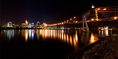
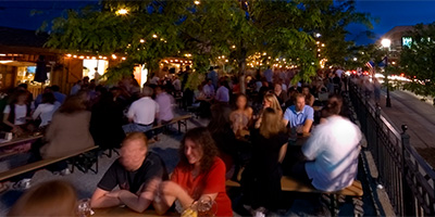 360 degree night panorama showing the Cincinnati skyline from across the Ohio River at the outdoor beer garden at Hofbrauhaus Newport, in the popular Newport-on the Levee entertainment area in Northern Kentucky.
Equipment: Nikon D70s, Sigma 8mm, Kaidan QuickPan III, PocketWizard Plus
Categories: Cincinnati, Ohio
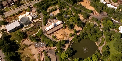 Cincinnati Zoo and Botanical Garden
Equipment: Nikon D70s, Sigma 8mm, PocketWizard Plus
Helicopter: Signature Engines, Inc.
Pilot: Bill Schmidt
Categories: Cincinnati, Ohio
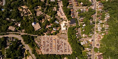 Over the parking lot at the Cincinnati Zoo.
Equipment: Nikon D70s, Sigma 8mm, PocketWizard Plus
Helicopter: Signature Engines, Inc.
Pilot: Bill Schmidt
Categories: Cincinnati, Ohio
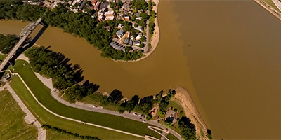 Confluence of Ohio and Licking River
Equipment: Nikon D70s, Sigma 8mm, PocketWizard Plus
Helicopter: Signature Engines, Inc.
Pilot: Bill Schmidt
Categories: Cincinnati, Ohio
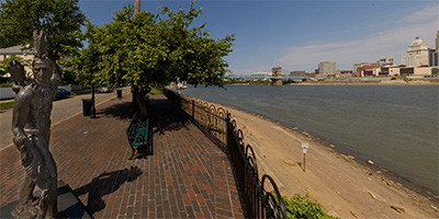
 360 degree panorama near a bench and statue along the Ohio River in Covington, Kentucky, across from Cincinnati, Ohio.
Equipment: Nikon D70s, Sigma 8mm, Kaidan QuickPan III, PocketWizard Plus
Categories: Cincinnati, Ohio
 360 degree panorama near Indian statue in Covington, Kentucky, near the confluence of the Licking and the Ohio rivers, across from Cincinnati, Ohio.
Equipment: Nikon D70s, Sigma 8mm, Kaidan QuickPan III, PocketWizard Plus
Categories: Cincinnati, Ohio
 360 degree panorama of the Ohio River and Cincinnati skyline at night from the Covington, Kentucky side, near Embassy Suites and the Northern Kentucky Convention Center. The John Roebling Suspension Bridge connecting downtown Cincinnati, Ohio and Covington, Kentucky was a prototype for the Brooklyn Bridge, also designed by Roebling.
Equipment: Nikon D70s, Sigma 8mm, Kaidan QuickPan III, PocketWizard Plus
Categories: Cincinnati, Ohio
 CVG Airport
Equipment: Nikon D70s, Sigma 8mm, PocketWizard Plus
Helicopter: Signature Engines, Inc.
Pilot: Bill Schmidt
Categories: Cincinnati, Ohio
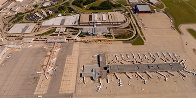 CVG Airport S. of terminal
Equipment: Nikon D70s, Sigma 8mm, PocketWizard Plus
Helicopter: Signature Engines, Inc.
Pilot: Bill Schmidt
Categories: Cincinnati, Ohio
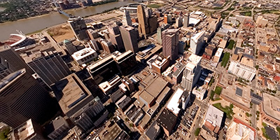
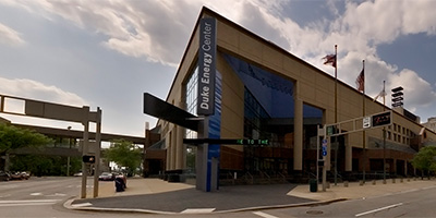
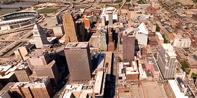
 360 degree aerial panorama of downtown Cincinnati, Ohio, over 7th St. W between Elm St. and Race St., north of the Millennium Hotel and northeast of the Duke Energy Center.
Equipment: Nikon D70s, Sigma 8mm, PocketWizard Plus
Helicopter: D&M Aviation Inc. 513-602-3177
Pilot: Dan Kelly
Categories: Cincinnati, Ohio
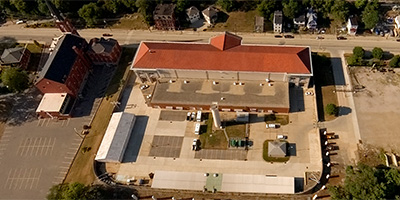
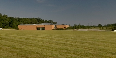
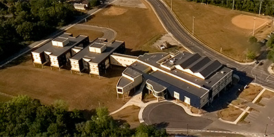 Some kind of elevated building, probably a school, on the north shore of the Ohio River east of Cincinnati, Ohio
Equipment: Nikon D70s, Sigma 8mm, PocketWizard Plus
Helicopter: Signature Engines, Inc.
Pilot: Bill Schmidt
Categories: Cincinnati, Ohio
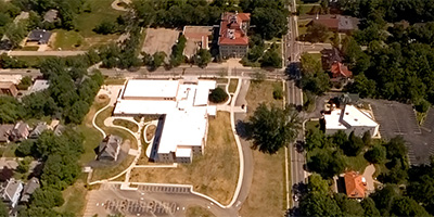 360 degree aerial panorama over Fairview Elementary School on Clifton Ave. in Cincinnati, Ohio.
Equipment: Nikon D70s, Sigma 8mm, PocketWizard Plus
Helicopter: Signature Engines, Inc.
Pilot: Bill Schmidt
Categories: Cincinnati, Ohio
 360 degree panorama at Fountain Square in downtown Cincinnati, Ohio
Equipment: Nikon D70s, Sigma 8mm, Kaidan QuickPan III, PocketWizard Plus
Categories: Cincinnati, Ohio
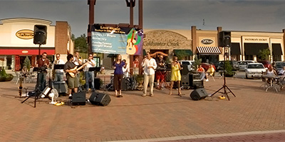
 360 degree panorama of German dancers near the Goose Girl Fountain in Mainstrasse Village, a restored German village in Covington, Kentucky. This is during Maifest 2007, a festival based on the German tradition of welcoming the first spring wines.
Equipment: Nikon D70s, Sigma 8mm, Kaidan QuickPan III, PocketWizard Plus
Categories: Cincinnati, Ohio
 Good Samaritan Hospital
Equipment: Nikon D70s, Sigma 8mm, PocketWizard Plus
Helicopter: Signature Engines, Inc.
Pilot: Bill Schmidt
Categories: Cincinnati, Ohio
 North of Good Samaritan Hospital
Equipment: Nikon D70s, Sigma 8mm, PocketWizard Plus
Helicopter: Signature Engines, Inc.
Pilot: Bill Schmidt
Categories: Cincinnati, Ohio
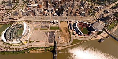
 360 degree aerial panorama over the Great American Ball Park and the US Bank Arena along the Ohio River in Cincinnati, Ohio.
Equipment: Nikon D70s, Sigma 8mm, PocketWizard Plus
Helicopter: D&M Aviation Inc. 513-602-3177
Pilot: Dan Kelly
Categories: Cincinnati, Ohio
 360 degree panorama outside of the Great American Ball Park, home of the Cincinnati Reds, in downtown Cincinnati, Ohio.
Equipment: Nikon D70s, Sigma 8mm, Kaidan QuickPan III, PocketWizard Plus
Categories: Cincinnati, Ohio
 Houston Road/Donaldson Hwy. Area in Erlanger
Equipment: Nikon D70s, Sigma 8mm, PocketWizard Plus
Helicopter: Signature Engines, Inc.
Pilot: Bill Schmidt
Categories: Cincinnati, Ohio
 I-275/Hwy 212 near CVG Airport
Equipment: Nikon D70s, Sigma 8mm, PocketWizard Plus
Helicopter: Signature Engines, Inc.
Pilot: Bill Schmidt
Categories: Cincinnati, Ohio
 I-71/I-75 at Hwy. 8 in Covington, Kentucky.
Equipment: Nikon D70s, Sigma 8mm, PocketWizard Plus
Helicopter: Signature Engines, Inc.
Pilot: Bill Schmidt
Categories: Cincinnati, Ohio
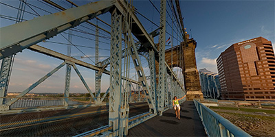 Sunset from the John Roebling Suspension Bridge connecting Cincinnati and Covington.
Equipment: ,
Categories: Bridges, Cincinnati, Ohio
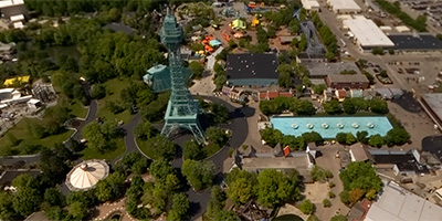 360 degree aerial panorama just north of the 1/3 scale Eiffel Tower at Kings Island amusement park in Mason, Ohio, 24 miles northeast of Cincinnati and 35 miles south of Dayton, Ohio.
Equipment: Nikon D70s, Sigma 8mm, PocketWizard Plus
Helicopter: D&M Aviation Inc. 513-602-3177
Pilot: Dan Kelly
Categories: Cincinnati, Ohio
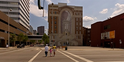 360 degree panorama in downtown Cincinnati at the intersection of Central Parkway and Vine St., next to the Kroger Building, and across from the Brotherhood Building with its awesome trompe l’oeil mural of Cincinnatus.
Equipment: Nikon D70s, Sigma 8mm, Kaidan QuickPan III, PocketWizard Plus
Categories: Cincinnati, Ohio
 Over Licking River at Hwy. 9 in Newport, Kentucky
Equipment: Nikon D70s, Sigma 8mm, PocketWizard Plus
Helicopter: Signature Engines, Inc.
Pilot: Bill Schmidt
Categories: Cincinnati, Ohio
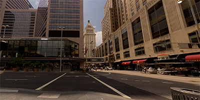
 Over Main St. at 9th St. in downtown Cincinnati, Ohio.
Equipment: Nikon D70s, Sigma 8mm, PocketWizard Plus
Helicopter: Signature Engines, Inc.
Pilot: Bill Schmidt
Categories: Cincinnati, Ohio
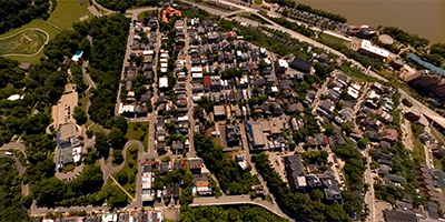
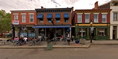 360 degree panorama in Mainstrasse Village, a restored German village in Covington, Kentucky.
Equipment: Nikon D70s, Sigma 8mm, Kaidan QuickPan III, PocketWizard Plus
Categories: Cincinnati, Ohio
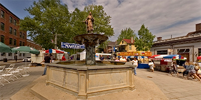 360 degree panorama at the Goose Girl Fountain in Mainstrasse Village, a restored German village in Covington, Kentucky.
Equipment: Nikon D70s, Sigma 8mm, Kaidan QuickPan III, PocketWizard Plus
Categories: Cincinnati, Ohio
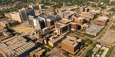
 360 degree aerial panorama northeast of the University of Cincinnati, and southwest of the University Hospital.
Equipment: Nikon D70s, Sigma 8mm, PocketWizard Plus
Helicopter: D&M Aviation Inc. 513-602-3177
Pilot: Dan Kelly
Categories: Cincinnati, Ohio
 360 degree panorama overlooking the Ohio River from the Newport Aquarium at Newport-on the Levee, an entertainment complex in Northern Kentucky across the river from Cincinnati, Ohio.
Equipment: Nikon D70s, Sigma 8mm, Kaidan QuickPan III, PocketWizard Plus
Categories: Cincinnati, Ohio
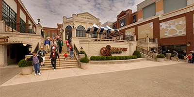
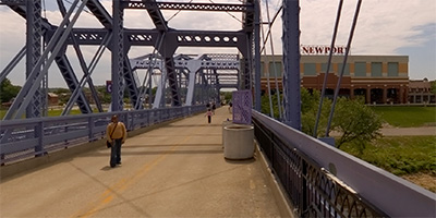
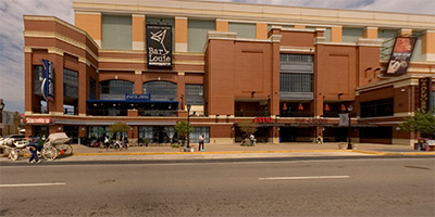 360 degree panorama from the street in front of Newport on the Levee, an entertainment complex in Northern Kentucky.
Equipment: Nikon D70s, Sigma 8mm, Kaidan QuickPan III, PocketWizard Plus
Categories: Cincinnati, Ohio
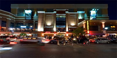 360 degree panorama at night from the street in front of Newport-on the Levee, a popular entertainment complex in Northern Kentucky.
Equipment: Nikon D70s, Sigma 8mm, Kaidan QuickPan III, PocketWizard Plus
Categories: Cincinnati, Ohio
 North of the Courthouse in Cincinnati
Equipment: Nikon D70s, Sigma 8mm, PocketWizard Plus
Helicopter: Signature Engines, Inc.
Pilot: Bill Schmidt
Categories: Cincinnati, Ohio
 360 degree aerial panorama over the Northern Kentucky Convention Center in Covington, Kentucky, across the river from Cincinnati, Ohio.
Equipment: Nikon D70s, Sigma 8mm, PocketWizard Plus
Helicopter: D&M Aviation Inc. 513-602-3177
Pilot: Dan Kelly
Categories: Cincinnati, Ohio
 360 degree panorama next to the Northern Kentucky Convention Center in Covington, Kentucky, across the Ohio River from Cincinnati, Ohio.
Equipment: Nikon D70s, Sigma 8mm, Kaidan QuickPan III, PocketWizard Plus
Categories: Cincinnati, Ohio
 Ohio River north of Covington, KY, west of hotels.
Equipment: Nikon D70s, Sigma 8mm, PocketWizard Plus
Helicopter: Signature Engines, Inc.
Pilot: Bill Schmidt
Categories: Cincinnati, Ohio
 Ohio River north of Covington, KY.
Equipment: Nikon D70s, Sigma 8mm, PocketWizard Plus
Helicopter: Signature Engines, Inc.
Pilot: Bill Schmidt
Categories: Cincinnati, Ohio
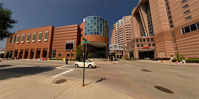
 360 degree panorama in downtown Cincinnati at the intersection of Elm St. and 5th St., next to the Duke Energy Center, Millennium Hotel, and Hyatt.
Equipment: Nikon D70s, Sigma 8mm, Kaidan QuickPan III, PocketWizard Plus
Categories: Cincinnati, Ohio
 360 degree panorama in front of the Cincinnati Music Hall, across the street from Washington Park in the historic Over-The-Rhine neighborhood in Cincinnati, Ohio.
Equipment: Nikon D70s, Sigma 8mm, Kaidan QuickPan III, PocketWizard Plus
Categories: Cincinnati, Ohio
 Over the I-471/I-275 interchange in Northern Kentucky.
Equipment: Nikon D70s, Sigma 8mm, PocketWizard Plus
Helicopter: Signature Engines, Inc.
Pilot: Bill Schmidt
Categories: Cincinnati, Ohio
 Over Main St. at 6th St. in downtown Cincinnati, Ohio.
Equipment: Nikon D70s, Sigma 8mm, PocketWizard Plus
Helicopter: Signature Engines, Inc.
Pilot: Bill Schmidt
Categories: Cincinnati, Ohio, World Wide Panorama
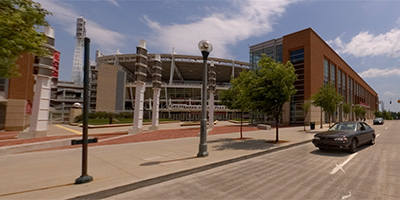
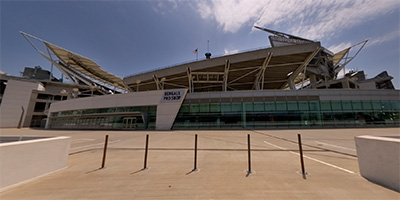 360 degree panorama in downtown Cincinnati, Ohio, outside of the Paul Brown Stadium, home of the Cincinnati Bengals.
Equipment: Nikon D70s, Sigma 8mm, Kaidan QuickPan III, PocketWizard Plus
Categories: Cincinnati, Ohio
 360 degree panorama on the Plaza Level of Newport on the Levee, an entertainment complex in Northern Kentucky across the river from Cincinnati, Ohio.
Equipment: Nikon D70s, Sigma 8mm, Kaidan QuickPan III, PocketWizard Plus
Categories: Cincinnati, Ohio
 360 degree panorama over the Ohio River on the Newport Southbank Bridge (AKA The Purple People Bridge) near Newport-on the Levee, an entertainment complex in Northern Kentucky across the river from Cincinnati, Ohio.
Equipment: Nikon D70s, Sigma 8mm, Kaidan QuickPan III, PocketWizard Plus
Categories: Cincinnati, Ohio
 S. of University Hospital
Equipment: Nikon D70s, Sigma 8mm, PocketWizard Plus
Helicopter: Signature Engines, Inc.
Pilot: Bill Schmidt
Categories: Cincinnati, Ohio
 SW of University Hospital
Equipment: Nikon D70s, Sigma 8mm, PocketWizard Plus
Helicopter: Signature Engines, Inc.
Pilot: Bill Schmidt
Categories: Cincinnati, Ohio
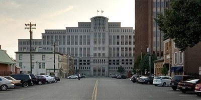
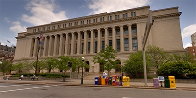 360 degree panorama at the intersection of Court St. and Main St., and the courthouse in downtown Cincinnati, Ohio.
Equipment: Nikon D70s, Sigma 8mm, Kaidan QuickPan III, PocketWizard Plus
Categories: Cincinnati, Ohio
 360 degree aerial panorama over the Health Professionals Building in Cincinnati, Ohio, west of Cincinnati Children’s Hospital and University Hospital, and northeast of the University of Cincinnati.
Equipment: Nikon D70s, Sigma 8mm, PocketWizard Plus
Helicopter: D&M Aviation Inc. 513-602-3177
Pilot: Dan Kelly
Categories: Cincinnati, Ohio
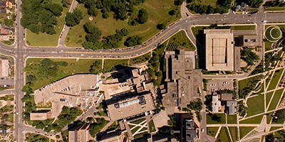
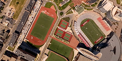 Over the track or soccer field at the University of Cincinnati.
Equipment: Nikon D70s, Sigma 8mm, PocketWizard Plus
Helicopter: Signature Engines, Inc.
Pilot: Bill Schmidt
Categories: Cincinnati, Ohio
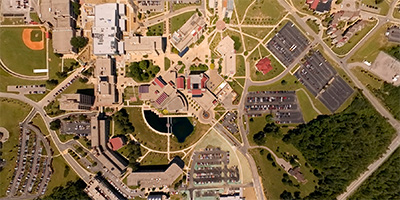
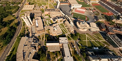
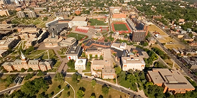
 University of Cincinnati
Equipment: Nikon D70s, Sigma 8mm, PocketWizard Plus
Helicopter: Signature Engines, Inc.
Pilot: Bill Schmidt
Categories: Cincinnati, Ohio
 University of Cincinnati
Equipment: Nikon D70s, Sigma 8mm, PocketWizard Plus
Helicopter: Signature Engines, Inc.
Pilot: Bill Schmidt
Categories: Cincinnati, Ohio
 University of Cincinnati
Equipment: Nikon D70s, Sigma 8mm, PocketWizard Plus
Helicopter: Signature Engines, Inc.
Pilot: Bill Schmidt
Categories: Cincinnati, Ohio
 University of Cincinnati
Equipment: Nikon D70s, Sigma 8mm, PocketWizard Plus
Helicopter: Signature Engines, Inc.
Pilot: Bill Schmidt
Categories: Cincinnati, Ohio
 University of Cincinnati
Equipment: Nikon D70s, Sigma 8mm, PocketWizard Plus
Helicopter: Signature Engines, Inc.
Pilot: Bill Schmidt
Categories: Cincinnati, Ohio
 Martin Luther King Drive at University of Cincinnati
Equipment: Nikon D70s, Sigma 8mm, PocketWizard Plus
Helicopter: Signature Engines, Inc.
Pilot: Bill Schmidt
Categories: Cincinnati, Ohio
360 degree aerial panorama over the Ohio River, just east of the John Roebling Suspension Bridge in Covington, Kentucky, across the river from Cincinnati, Ohio.
Equipment: ,
Helicopter: D&M Aviation Inc. 513-602-3177
Pilot: Dan Kelly
Categories: Cincinnati, Ohio
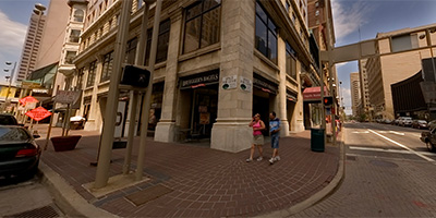 360 degree panorama at the intersection of Fourth St. and Vine St. in downtown Cincinnati, Ohio.
Equipment: Nikon D70s, Sigma 8mm, Kaidan QuickPan III, PocketWizard Plus
Categories: Cincinnati, Ohio
 Over W. Robbins St. in Covington, Kentucky
Equipment: Nikon D70s, Sigma 8mm, PocketWizard Plus
Helicopter: Signature Engines, Inc.
Pilot: Bill Schmidt
Categories: Cincinnati, Ohio
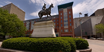 360 degree panorama next to the William Henry Harrison statue at Elm St. and Garfield Pl. in downtown Cincinnati, Ohio.
Equipment: Nikon D70s, Sigma 8mm, Kaidan QuickPan III, PocketWizard Plus
Categories: Cincinnati, Ohio

Start with the "Featured" category to see an assortment of my most interesting panoramas.